Forthcoming geophysical data releases
Thursday 26 July 2012 after 0900 AWST (UTC +8)
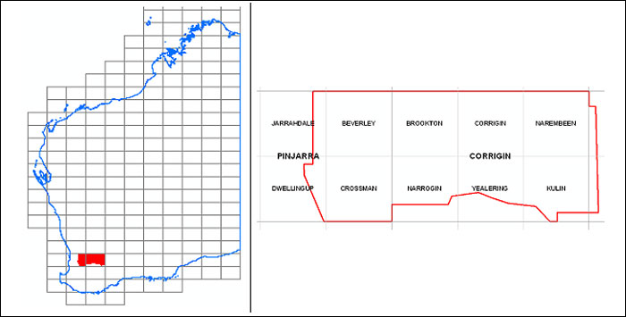
Corrigin 2012 airborne magnetic and radiometric survey — final data
Images and grids of final data from the regional magnetic and radiometric survey at line spacing of 200 m completed in March 2012 will be available from the GSWA website on the Latest Geophysical Surveys page at www.dmp.wa.gov.au/geophysics.
Point-located ('vector') data and grids from this survey can be purchased on disk from Geoscience Australia or downloaded free of charge from the Geophysical Archive Data Delivery System (GADDS).
Thursday 2 August 2012 after 0900 AWST (UTC +8)
Perth Basin North 2011 airborne magnetic and radiometric survey — final data
Images and grids of final data from the regional magnetic and radiometric survey at line spacing of 400 m completed in December 2011 will be available from the GSWA website on the Latest Geophysical Surveys page at www.dmp.wa.gov.au/geophysics.
Point-located ('vector') data and grids from this survey can be purchased on disk from Geoscience Australia or downloaded free of charge from the Geophysical Archive Data Delivery System (GADDS).

Preliminary grids and images were released on 22 February 2012 and are available for download from www.dmp.wa.gov.au/14374.aspx
Latest Geophysics Program update
Access to previously released geophysical data
Image data from previous geophysical releases can be found on our Regional Geophysical Surveys page. Digital located and grid data can be purchased on media from Geoscience Australia or downloaded free of charge through the Geophysical Archive Data Delivery System (GADDS).
Training in GSWA databases and online systems
Attend a free training session hosted by the Department of Mines and Petroleum to demonstrate current online systems. The format is an interactive presentation which includes navigating the DMP website, searching for publications, finding mineral deposits using MINEDEX, finding digital datasets using the Data and Software Centre, open file mineral exploration reports using WAMEX, and bringing it all together with the interactive map viewer (GeoVIEW.WA). GeoMap.WA, a new GIS viewer for Windows, will also be demonstrated.
The morning sessions will be a high-level demonstration and overview of the use of all the programs. At the afternoon sessions, participants will be able to practise the programs using their own examples and get some one-on-one advice about individual issues. You can attend one or both sessions.
We take a maximum of 12 for the Perth session and 25 for the Kalgoorlie session for maximum comfortable learning for the participants.
Perth
ISB Training room, Ground floor
Mineral House, 100 Plain Street, East Perth
9 am – 12 noon, 2–5 pm – Monday 6 August
9 am – 12 noon, 2–5 pm – Wednesday 7 November
Kalgoorlie
WA School of Mines, Mine Design Lab, Room 131, Building 703, Odwyn Jones Building, corner Cassidy and MacDonald Streets, central Kalgoorlie.
9 am – 12 noon, 2–5 pm – Wednesday 14 November
To register, email your details to publications@dmp.wa.gov.au.
Spotlight on a product
by Evins, PM, Kirkland CL, Wingate, MTD, Smithies, RH, Howard, HM, and Bodorkos, S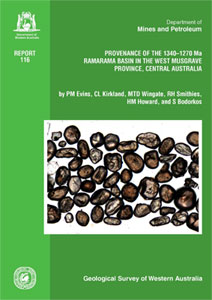
This report outlines the development of the Ramarama Basin of the west Musgrave Province.
The basin comprises calc-alkaline volcanic and intrusive rocks of the 1345–1293 Ma Wankanki Supersuite interleaved with paragneisses of the Wirku Metamorphics. The majority of the paragneisses had sedimentary precursors that were deposited between c. 1340 and 1300 Ma. Detrital zircon age spectra from samples of Wirku Metamorphics reveal younging trends within northwest-trending geographic/tectonic zones.
Dominant detrital zircon age components range from c. 1570 Ma in the northeast to c. 1520 Ma in the centre to c. 1330 Ma in the southwest. Detrital zircons with Archean ages similar to those in the Yilgarn Craton are present to the southeast.
The Ramarama Basin is interpreted as part of a calc-alkaline magmatic arc with compositional similarities to Andean-style continental arcs. Constraints from this study suggest development of the Ramarama Basin above a north-dipping subduction zone between the North and South Australian Cratons in the c. 1340 to 1300 Ma period.
The Report is now available.
34th IGC workshop — 3D mineral mapping from drill core to space
Workshop 22 is to be held at the 34th IGC in Brisbane 2012, entitled: 3D Mineral Mapping from drill core to space — Applications of VIRS technologies for mineral mapping and exploration, scheduled for 11 August 2012.
This course aims to provide the background theoretical spectral knowledge to improve skills for using hyper- and multispectral data for mineral mapping and exploration. The newly released Australian ASTER geoscience products, as well as airborne and drill core hyperspectral derived mineral mapping information will be presented and used in hands-on case studies for analysing hydrothermal alteration systems and targeting channel iron deposits.
More information about the short course can be found at www.34igc.org/workshops.php.
Please notice that there will be a closely related theme 32: Geoscience Information from Proximal and Remote Sensing Technologies. See www.34igc.org/scientific-themes-symposia.php for details.
Latest releases
REPORTS
Report 115 A multi-isotopic approach to the crustal evolution of the west Musgrave Province, central Australia
by Kirkland, CL, Smithies, RH, Woodhouse, A, Howard, H, Wilson, AC, Belousova, EA, Cliff, JB, Murphy, R, and Spaggiari, C
Report 116 Provenance of the 1340–1270 Ma Ramarama Basin in the west Musgrave Province, central Australia
by Evins, PM, Kirkland CL, Wingate, MTD, Smithies, RH, Howard, HM, and Bodorkos, S
RECORDS
Record 2011/25 Capricorn Orogen seismic and magnetotelluric (MT) workshop 2011: extended abstracts
by Johnson, SP, Thorne, AM, and Tyler, IM
Record 2011/23 The geology of the east Albany–Fraser Orogen — a field guide
by CV Spaggiari, CL Kirkland, MJ Pawley, RH Smithies, MTD Wingate, MG Doyle, TG Blenkinsop, C Clark, CW Oorschot, LJ Fox, and J Savage
Record 2012/7 Geochronological and isotopic constraints on the tectonic setting of the c. 1800 Ma Hart Dolerite and the Kimberley and Speewah Basins, northern Western Australia
by Sheppard, S, Page, RW, Griffin, TJ, Rasmussen, B, Fletcher, IR, Tyler, IM, Kirkland, CL, Wingate, MTD, Hollis, JA, and Thorne, AM
Record 2012/8 Field observations relating to the c. 2740 Ma Mopoke Member, Kylena Formation, Fortescue Group, Pilbara region, Western Australia
by Flannery, DT, Hoshino, Y, George, SC, and Walter, MR
Record 2012/10 A billion years of Earth history: a geological transect through the Pilbara Craton and the Mount Bruce Supergroup — a field guide to accompany 34th IGC excursion WA-2
by Van Kranendonk, MJ and Hickman, AH
GEOLOGICAL MAPS 1:100 000
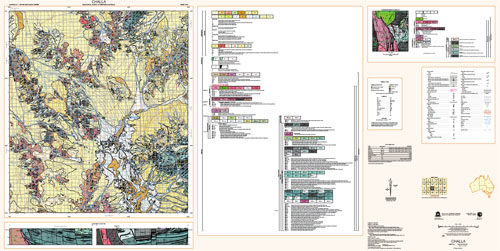
CHALLA 1:100 000 Geological Series map WA Sheet 2541
by Ivanic, T
MOUNT EVELINE 1:100 000 Geological Series map WA Sheet 4345
by Smithies, RH
WINDIMURRA 1:100 000 Geological Series map WA Sheet 2641
by Ivanic, T
CARLINDIE 1:100 000 Geological Series map WA Sheet 2756
by Van Kranendonk, MJ
TAMBOURAH WA Sheet 2754 1:100 000 Geological Series map 2nd edition
TEANO WA Sheet 2449 1:100 000 Geological Series map
EIS MOUNT VERNON 1:100 000 Geological Series map WA Sheet 2549
RESOURCE POTENTIAL FOR LAND USE PLANNING
Fremantle–Jarrahdale — Regionally significant basic raw materials
Ledge Point – Gingin — Regionally significant basic raw materials
Perth–Wooroloo — Regionally significant basic raw materials
NON-SERIES MAPS
Iron ore deposits of the Yilgarn Craton, 2012
Plate 1 Interpreted Pre-Mesozoic bedrock geology of the east Albany–Fraser Orogen and southeast Yilgarn Craton
by Spaggiari, C and Pawley, M
Plate 1A Geophysical and remote sensing imagery and reference for Plate 1, east Albany–Fraser Orogen and southeast Yilgarn Craton
by Spaggiari, C and Pawley, M
Plate 2 Interpreted Pre-Mesozoic bedrock geology of the Tropicana region of the east Albany–Fraser Orogen
by Spaggiari, C and Pawley, M
GEOLOGICAL INFORMATION PACKAGES 1:100 000
EIS Kimberley GIS update 2012
West Musgrave GIS 2012
Regolith geochemistry of WA (1:250:000)
NON-SERIES DIGITAL PRODUCTS
Compilation of geochronology information, 2012
DATA PACKAGE
1:250 000 digital data package – Regolith and ASTER maps of Western Australia 2012
WA Coast — Gascoyne
by Gozzard, JR
WA Coast — Pilbara
by Gozzard, JR
Access GSWA products
You can download maps, reports, and digital information free of charge from our website.
Click on these links to take you to the download page for that product:
- Geoscience information, maps and reports
- GIS versions of maps
- Interactive geological map (GeoVIEW.WA)
- Promotional flyers and posters
- GeoMap.WA GIS software
- Mineral deposits and mine information (MINEDEX)
- Mineral exploration reports (WAMEX)
- Petroleum and geothermal information (WAPIMS)
- TENGRAPH online
- Airborne geophysics index (MAGIX)
- Geochronology
- Geochemistry (GeoChem Extract)
- Petroleum Geothermal Register (PGR)
Hard copies
Hard copy publications are also available to purchase from the eBookshop or the First Floor counter at Mineral House, 100 Plain Street, East Perth, WA 6004.

Contact us
For information on publications, email publications@dmp.wa.gov.au
or telephone +61 8 9222 3459/ fax +61 8 9222 3444.
For information on digital data, email the Digital data administrator on gsd.dda@dmp.wa.gov.au
or telephone +61 8 9222 3816.
Physical address
Mineral House
100 Plain Street
East Perth WA 6004
www.dmp.wa.gov.au/gswa
For more information about GSWA and its products, go to the GSWA website.