Department changes
The State Government’s Machinery of Government reforms have merged the majority of the former Department of Mines and Petroleum with the former Department of Commerce to create the Department of Mines, Industry Regulation and Safety (DMIRS).
The Resource and Environmental Regulation Group is one of five new groups in the department’s new organisational structure. The Group was created by transferring personnel and functions from the former Mineral Titles, Petroleum, Environment, and Geological Survey Divisions into the new Resource Tenure, Resource and Environmental Compliance, and Geoscience and Resource Strategy Divisions.
For more information, please contact Executive Director Geoscience and Resource Strategy, Jeff Haworth.
Great news — Exploration Incentive Scheme (EIS) continues!
In the recent State Budget, the government announced it will extend the Exploration Incentive Scheme (EIS). With Minister Johnston’s strong support and advocacy, the EIS will continue at $10 million per year with funds raised through an increase in the Mining Tenement Rent (MTR) over the next two years.
The flagship Co-funded Exploration Drilling program will continue with an allocation of $5 million per year, as has been the case since 2009–10. The co-funded drilling application process for Round 18 will open in September, for a 12-month drilling period from 1 January 2019 to 31 December 2019.
The remaining $5 million per annum is set to deliver four programs strategically aligned to the National Mineral Exploration Strategy and to the UNCOVER Australia/AMIRA industry roadmap: ‘Unlocking Australia’s Hidden Potential’. The programs are:
- Geophysical surveys
- Airborne and ground surveys, e.g. gravity
- Deep crustal seismic and magnetotelluric
- Encouraging exploration through cover
- Exploration data analysis
- Regolith geochemical and resistate mineral surveys
- Regolith and 3D paleosurface mapping
- 3D prospectivity mapping
- Mineral systems
- Petroleum systems
- WA Geology online
- 3D lithospheric visualization
- Mapping geodynamic setting
- Enhanced geochronology and isotopic fingerprinting
- Promoting strategic research with industry
- MRIWA support
DMIRS will administer the funding, and there will be no cost to industry for EIS-acquired pre-competitive geoscience data. All data and geoscience publications will be provided free of charge when downloaded from the DMIRS website.
The continuation of the EIS beyond 2019–20 will build on the success of past EIS programs, which provided substantial economic benefits to the State and resource industry, and raised Western Australia’s profile as a mining investment destination of choice.
Free database and online systems training
Learn  how to access geoscience data online and understand the department’s systems at these FREE training courses.
Systems include:
- WAMEX
- GeoVIEW.WA
- GeoMap.WA
- TENGRAPH Web
- Data and Software Centre
- Mineral drill holes and geochemistry databases
- Department website
A desktop computer will be available for each participant.
PERTH SESSIONS
The Perth training has been divided into two sessions: for mining companies/geologists (morning), and for prospectors (afternoon).
- Thursday 7 June
- Thursday 8 November
TENGRAPH Web training
- Wednesday 13 June
KALGOORLIE
The Kalgoorlie training is open to anyone (full day).
- Friday 15 June (session is full)
- Friday 16 November
Register
To register for the Perth and Kalgoorlie sessions, email publications@dmirs.wa.gov.au. To register for the separate TENGRAPH Web training, email tengraph@dmirs.wa.gov.au. Please include your details (name, company name, telephone number), with the name, location and date of the training you wish to attend. For the Perth sessions, please indicate whether you wish to attend the prospector or mining companies/geologist training.
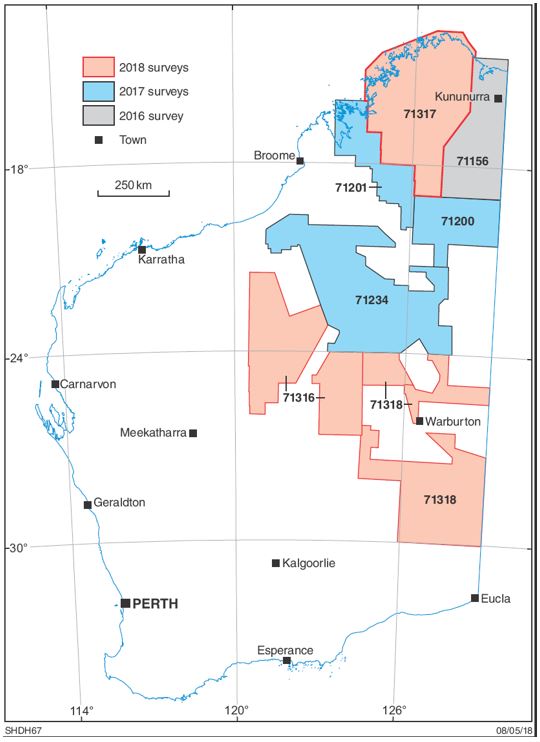
Status of regional aerogravity surveys in Western Australia
DMIRS in collaboration with Geoscience Australia (GA), has contracted Sander Geophysics to undertake three new airborne gravity surveys in the north and east of the State as part of its 2018–19 regional data acquisition program. At a line spacing of 2.5 km, the 175 000 line-km of planned flight path covers an aggregate area of 450 000 km2 (Fig. 1, Table 1).
The contracts were awarded following a public tender issued by GA late in 2017 (see Preview December 2017). Acquisition began in the Little Sandy Desert survey area at the end of April, with work in the other two areas scheduled to begin before the end of June.
From the 2017–18 program, DMIRS and GA released data from the Tanami and Northeast Canning surveys (50 000 line-km) on 12 April 2018, with data from the large, 70 000 line-km Kidson survey anticipated to follow by the end of June 2018.
Weekly updates of the status of the surveys are posted at www.dmp.wa.gov.au/geophysics.
Survey data releases are available from the national Geophysical Archive Data Delivery System at www.ga.gov.au/gadds, and from the department’s GeoVIEW.WA system at www.dmp.wa.gov.au/geoview (under the ‘Company Airborne Surveys’ layer in the ‘Geophysical Surveys’ group, searching on the relevant survey registration number shown in Table 1).
For more information contact David Howard on geophysics@dmirs.wa.gov.au.
Table 1. DMIRS aerogravity surveys in Western Australia
Regn. No. |
Survey name |
Size |
Contractor |
Technology |
Status |
|
71156 |
East Kimberley 2016 |
38 000 |
Sander Geophysics |
AIRGrav |
Data released |
|
71200 |
Tanami 2017 |
25 000 |
Thomson Aviation/CMGO |
GT-2A |
Data released |
|
71201 |
Northeast Canning 2017 |
25 000 |
Thomson Aviation/CMGO |
GT-2A |
Data released |
|
71234 |
Kidson 2017 |
75 000 |
CGG Aviation |
FALCON |
Scheduled data release end-June 2018 |
|
71316 |
Little Sandy Desert 2018 |
52 000 |
Sander Geophysics |
AIRGrav |
Acquisition started |
|
71317 |
Kimberley Basin 2018 |
61 000 |
Sander Geophysics |
AIRGrav |
Survey scheduled |
|
71318 |
Warburton – Great Victoria Desert 2018 |
62 000 |
Sander Geophysics |
AIRGrav |
Survey scheduled |
Figure 1. Location of DMIRS aerogravity surveys
Kidson Sub-basin seismic survey
A deep seismic 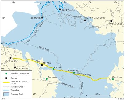 reflection survey is planned for the Canning Basin region (Great Sandy Desert) in northern Western Australia. The survey is a collaborative research project between Geoscience Australia (GA) and the Geoscience and Resource Strategy Division (GRSD), a division of the Department of Mines, Industry Regulation and Safety (DMIRS).
The survey is planned to be acquired between June and August 2018 over a period of 10 to 12 weeks, dependent on the weather conditions, community considerations and equipment. The Kidson Sub-basin deep crustal seismic reflection survey consists of a single seismic line designed to complete a geological cross-section of the Kidson Sub-basin in the southern Canning Basin. The geology and the structure of the Kidson Sub-basin is one of the least scientifically understood in onshore Australia, and is very poorly covered by seismic data.
The main objectives of the project are to acquire deep crustal seismic data to:
- image the structure of the basement below the Kidson Sub-basin of the southern Canning Basin, including the extent of major tectonic units such as the Centralian Superbasin, the West Arunta Orogen, the Paterson Orogen and the Pilbara Craton, and the nature of their boundaries
- establish the subsurface geology of the Canning Basin and the extent and nature of its sub-basins and troughs
- identify regional faults, folds and other structural elements.
A single line is proposed to be acquired along the road that links the Kiwirrkurra community in the east to Marble Bar in the west. The survey will commence from ~40 km (road distance) west of the Kiwirrkurra community and may finish ~20 km east of Marble Bar for a total length of up to 900 km (as shown in the figure above).
Flashback sale — special 50% discount for premium publications — while stocks last!
DMIRS is offering its premium publications backlist for a limited time at a discount of 50% off the original advertised price. Act now to get some huge geological bargains while stocks last!
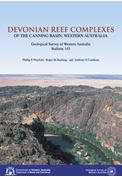
Bulletin 145 Devonian reef complexes – current price $50 – discounted price $25
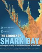
Bulletin 146 The geology of Shark Bay – current price $70 – discounted price $25
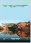
Discovery trails to early Earth – current price $25 – discounted price $15
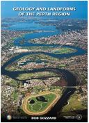
Geology and landforms of the Perth Region – current price $22 – discounted price $11
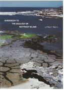
Guidebook to the geology of Rottnest Island – FREE
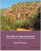
The birth of supercontinents – current price $33 – discounted price $15
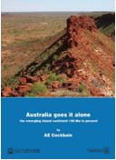
Australia goes it alone – current price $33 – discounted price $15
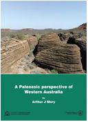
A Paleozoic perspective of WA – current price $33 – discounted price $15
MRB 15 Lead, zinc and silver deposits of Western Australia – FREE
MRB 16 Talc, pyrophyllite and magnesite in Western Australia – FREE
MRB 17 Barite and fluorite in Western Australia – FREE
MRB 18 Limestone and limesand resources of Western Australia – FREE
MRB 19 Kaolin in Western Australia – FREE
MRB 20 Bentonite, attapulgite, and common clays in Western Australia – FREE
MRB 21 Silica resources of Western Australia – FREE
MRB 22 Tantalum in Western Australia – FREE
To buy any of these publications, please email bookshop@dmirs.wa.gov.au. Shipping costs will be added to the discounted price.
New releases
REPORTS
Report 174 A review of palynology from the Harvey region, southern Perth Basin, Western Australia
by Martin, SK
Report 176 Tectono-magmatic evolution of the Neoarchean Yalgoo dome (Yilgarn Craton): diapirism in a pre-orogenic setting
by Zibra, I, Peternell, M, Schiller, M, Wingate, MTD, Lu, Y-J and Clos, F
Report 177 Crustal and uppermost mantle structure of the east Albany–Fraser Orogen from passive seismic data
by Sippl, C, Tkalcic, H, Kennett, BLN, Spaggiari, CV, Gessner, K, Brisbout, L and Murdie, RE
Report 181 New Hf isotopes into the Paleoarchean magmatic evolution of the Mount Edgar Dome, Pilbara Craton: implications for early Earth and crust formation processes
With accompanying ZIP file containing related data files
by Gardiner, N, Hickman, AH, Kirkland, CL, Lu, Y-J, Johnson, TE and Wingate, MTD
Report 183 Metamorphosed Mesoarchean Cu–Mo–Ag mineralization: evidence from the Calingiri deposits, southwest Yilgarn Craton
by Outhwaite, MD
Report 185 The mapped stratigraphy and structure of the mining area C region, Hamersley province (otherwise known as The Black Monolith)
by Kepert, DA
RECORDS
Record 2018/2 GSWA 2018 extended abstracts: promoting the prospectivity of Western Australia
Record 2018/4 A new Mesoproterozoic mafic intrusive event in the Capricorn Orogen
by Blay, OA, Johnson, SP, Wingate, MTD, Thorne, AM, Kirkland, CL, Tessalina, SG and Cutten, HN
Record 2018/5 A petrographic and geochronological assessment of the gabbroic and metagabbroic rocks of the Fraser Zone, Albany–Fraser Orogen, Western Australia
by Glasson, K
Record 2018/6 Post-conference field trip guide: the Leeuwin Complex, Western Australia
by Timms, N
MAPS
Aboriginal land, conservation areas, mineral and petroleum titles and geology, Western Australia — 2018
by Ridge, KJ
Major resource projects, Western Australia — 2018
by Cooper, RW, Wyche, NL, Strong, CA, Day, LJ, Jones, JA and Irimies, F
Mines – operating and under development, Western Australia — 2018
by Cooper, RW, Strong, CA, Wyche, NL, Day, LJ and Jones, JA
DATA PACKAGES
Diamond exploration and prospectivity of Western Australia
by Hutchison, M
Includes:
Report 179 Diamond exploration and prospectivity of Western Australia
Record 2017/16 Data methodologies applied in the Western Australian diamond exploration package
2017 Canning Basin SEEBASE study and GIS data package
by Frogtech Geoscience
Includes:
Report 182 2017 Canning Basin SEEBASE study and GIS data package
And accompanying ZIP file containing extra data
Access GSWA publications
Fieldnotes
Fieldnotes is a quarterly publication released by GSWA to provide the State's exploration industry and other geoscientists with an update on our latest work and ongoing programs. The publication provides updates on other GSWA products and services and is available free from the Information Centre located on the first floor of Mineral House, 100 Plain Street, East Perth 6004. Find past issues of Fieldnotes here or subscribe to receive a hard copy by emailing publications@dmirs.wa.gov.au.
eNewsletter
To join our mailing list and receive our monthly newsletter, go to our website and update your own details. Please subscribe to our newsletter or unsubscribe from our newsletter.
Access GSWA products
You can download maps, reports, and digital information free of charge from our website.
Click on these links to take you to the download or launch page for that product:
- Geoscience information, maps and reports
- GIS versions of maps and links to web services
- Interactive geological map (GeoVIEW.WA)
- Interactive geological map for mobile devices (WA Geology online)
- Explanatory Notes System (ENS)
- Promotional flyers and posters
- GeoMap.WA GIS software
- Mineral deposits and mine information (MINEDEX)
- Mineral exploration reports (WAMEX)
- Petroleum and geothermal information (WAPIMS)
- TENGRAPH online
- Airborne geophysics index (MAGIX)
- Geochronology
- Geochemistry (GeoChem Extract)
- Petroleum and Geothermal Register (PGR)
Hard copies
Maps, USB data packages, and nine premium publications are available to purchase as hard copies from the eBookshop or the First Floor counter at Mineral House, 100 Plain Street, East Perth WA 6004. A new online cart and payment system is in place. Records, reports, bulletins and other non-series books cannot be purchased in hard copy but are all available as PDFs to view and download free of charge.
Contact Us
For information on publications, email publications@dmirs.wa.gov.au or telephone +61 8 92223459/ fax +61 8 92223444.
For information on digital data, email the Digital Data Administrator on gsd.dda@dmirs.wa.gov.au or telephone +61 8 9222 3816.
Address
Mineral House
100 Plain Street
East Perth WA 6004
www.dmirs.wa.gov.au/gswa
For more information about GSWA go to our website.