Exploration Incentive Scheme co-funded drilling Round 18 opening soon
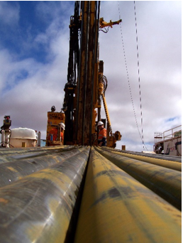
The next round of co-funded drilling (Round 18) will open for a six-week application period, starting on Friday 24 August and closing at 5pm WST on Friday 5 October 2018. Round 18 is for drilling between 1 January and 31 December 2019. Advice, guidelines and a copy of the co-funding agreement can be found at www.dmp.wa.gov.au/eisdrilling
For more information, contact Charlotte Hall, EIS coordinator charlotte.hall@dmirs.wa.gov.au
Have your say on draft amendments to guidelines for mineral exploration reports
The Department of Mines, Industry Regulation and Safety (DMIRS) has released proposed amendments to the Guidelines for Mineral Exploration Reports on Mining Tenements.
The Guidelines are designed to assist holders of mining tenements in Western Australia in the preparation and submission of mineral exploration reports that comply with section 115A of the Mining Act 1978.
The proposed amendments include:
- Purpose of the Guidelines — wording changed to more accurately reflect the meaning of an exploration report as defined in the Mining Act 1978
- Report compliance — two paragraphs have been combined into one
- Online submission of reports will become compulsory
- Structure of reports — wording changed to reflect more accurately the meaning of an exploration report as defined in the Mining Act 1978
- Mineralogical samples — detailing the format of the unique sample numbers
- Addition of the DMIRS program of works approval number and status of site rehabilitation to the surface location template.
More information, including a complete copy of the Guidelines with proposed amendments, is available on the department's consultation page. Comments close on 30 September 2018.
Free database and online systems training — only November sessions left for 2018
Learn how to access geoscience data online and understand the department’s systems at these FREE training courses.
Systems include:
- WAMEX
- GeoVIEW.WA
- GeoMap.WA
- TENGRAPH Web
- Data and Software Centre
- Mineral drill holes and geochemistry databases
- Department website
A desktop computer will be available for each participant.
PERTH SESSIONS
The Perth training has been divided into two sessions: for mining companies/geologists (morning), and for prospectors (afternoon).
- Thursday 8 November
KALGOORLIE
The Kalgoorlie training is open to anyone (full day).
- Friday 16 November
Register
To register for the Perth and Kalgoorlie sessions, email publications@dmirs.wa.gov.au. Please include your details (name, company name, telephone number), with the name, location and date of the training you wish to attend. For the Perth sessions, please indicate whether you wish to attend the mining companies/geologist (morning) or prospector (afternoon) training.
Flashback sale — special 50% discount for premium publications — while stocks last!
DMIRS is offering its premium publications backlist for a limited time at a discount of 50% off the original advertised price. Act now to get some huge geological bargains while stocks last!
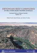
Bulletin 145 Devonian reef complexes – current price $50 – discounted price $25
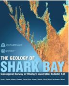
Bulletin 146 The geology of Shark Bay – current price $70 – discounted price $25
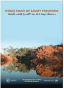
Discovery trails to early Earth – current price $25 – discounted price $15
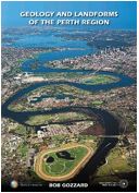
Geology and landforms of the Perth Region – current price $22 – discounted price $11
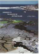
Guidebook to the geology of Rottnest Island – FREE
The birth of supercontinents – current price $33 – discounted price $15
Australia goes it alone – current price $33 – discounted price $15
A Paleozoic perspective of WA – current price $33 – discounted price $15
MRB 15 Lead, zinc and silver deposits of Western Australia – FREE
MRB 16 Talc, pyrophyllite and magnesite in Western Australia – FREE
MRB 17 Barite and fluorite in Western Australia – FREE
MRB 18 Limestone and limesand resources of Western Australia – FREE
MRB 19 Kaolin in Western Australia – FREE
MRB 20 Bentonite, attapulgite, and common clays in Western Australia – FREE
MRB 21 Silica resources of Western Australia – FREE
MRB 22 Tantalum in Western Australia – FREE
To buy any of these publications, please email bookshop@dmirs.wa.gov.au. Shipping costs will be added to the discounted price.
Product spotlight: The ‘Black Monolith’ resurfaces
This Report, known as ‘The Black Monolith’ and recently republished as GSWA Report 185, collates a number of detailed mapping programs carried out by BHP in the Hamersley province on its tenement holdings at Mining Area C, Mudlark Well and Weeli Wolli, between 1994 and 2001. The mapping covers some 590 km2 at scales ranging from 1:5000 to 1:20 000. Data and interpretations of the stratigraphy, structure and tectonic evolution of the area constitute one of the most comprehensive reports on this economically important region.
The work is a summary of the stratigraphy of the Mount Bruce Supergroup, in this area, from the upper part of the Fortescue Group to the top of the overlying Hamersley Group. It described the mineralisation and structure of the region and outlines the main controlling factors on the tectonic evolution of the Hamersley Basin within the context of the regional ideas at the time of writing.
‘The Black Monolith’ has been widely cited by those working on the world-class iron ore deposits of the Hamersley Basin, and remains an important record of the geology of the Hamersley province that deserves to be placed in the public domain.
Download GSWA Report 185 The mapped stratigraphy and structure of the Mining Area C region, Hamersley province.
New releases
REPORTS
Report 178 A seismic interpretation of the southwestern Canning Basin, Western Australia
by Y Zhan
Includes three plates and an accompanying data file:
Plate 1. Two-way time and average velocity to significant seismic horizons
Plate 2. Depth below mean sea level and surface to significant seismic horizons
Plate 3. Isopach maps of the pre-Permian and Permian strata
Report 185 The mapped stratigraphy and structure of the Mining Area C region, Hamersley province
by Kepert, DA
Report 186 Building the Archean continental crust: 300 Ma of felsic magmatism in the Yalgoo dome (Yilgarn Craton)
by Clos F, Weinberg, R and Zibra, I
Report 187 Detection and identification of rare earth elements using hyperspectral techniques
by Morin-Ka, S
RECORDS
Record 2018/3 Regolith chemistry of the Ngururrpa area, northeastern Western Australia
(includes an accompanying data file)
by Morris, PA, de Souza Kovacs, N and Scheib, AJ
Record 2018/4 A new Mesoproterozoic mafic intrusive event in the Capricorn Orogen
by Blay, OA, Johnson, SP, Wingate, MTD, Thorne, AM, Kirkland, CL, Tessalina, SG and Cutten, HN
Record 2018/7 3rd Lithosphere workshop, 5–6 November 2017, The University of Western Australia
compiled by Gorczyk, W and Gessner, K
Record 2018/9 The tectonothermal evolution of a portion of the southern Fraser mobile belt, Western Australia
by Standing, JG
Record 2018/10 Geochemistry of Archean granitic rocks in the South West Terrane of the Yilgarn Craton
by Smithies, RH, Lu, Y, Gessner, K, Wingate, MTD and Champion, DC
Explanatory Notes System online
Hamersley Group
Murchison 2018
Eastern Zone, Lamboo Province, Kimberley
Available at www.dmp.wa.gov.au/ens
GEOLOGICAL MAPS 1:100 000
Ninghan, WA Sheet SH 50-7
GEOLOGICAL MAPS 1:250 000
Macdonald, WA Sheet SF 52-14
Lansdowne, WA Sheet SE 52-5 (2nd edition)
NON-SERIES MAPS
Interpreted regolith–landform geology of the Ngururrpa area, northeastern Western Australia
DATA PACKAGES
Compilation of geochronology information, 2018
Compilation of HyLogger records, 2018
by Duuring, P
Compilation of WAROX data, 2018
East Yilgarn, 2018
Merlinleigh Sub-basin: 3D Geomodel Series
Mount Brockman Syncline (Hamersley Basin), 3D Geomodel Series
by Murdie, RE and Gessner, K
Western Australian Information for APPEA 2018, Adelaide
For products without links, please check online soon at www.dmp.wa.gov.au/ebookshopAccess GSWA publications
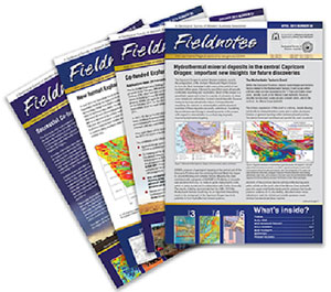
Fieldnotes
Fieldnotes is a quarterly publication released by GSWA to provide the State's exploration industry and other geoscientists with an update on our latest work and ongoing programs. The publication provides updates on other GSWA products and services and is available free from the Information Centre located on the first floor of Mineral House, 100 Plain Street, East Perth 6004. Find past issues of Fieldnotes here or subscribe to receive a hard copy by emailing publications@dmirs.wa.gov.au.
eNewsletter
To join our mailing list and receive our monthly newsletter, go to our website and update your own details. Please subscribe to our newsletter or unsubscribe from our newsletter.
Access GSWA products
You can download maps, reports, and digital information free of charge from our website.
Click on these links to take you to the download or launch page for that product:
- Geoscience information, maps and reports
- GIS versions of maps and links to web services
- Interactive geological map (GeoVIEW.WA)
- Interactive geological map for mobile devices (WA Geology online)
- Explanatory Notes System (ENS)
- Promotional flyers and posters
- GeoMap.WA GIS software
- Mineral deposits and mine information (MINEDEX)
- Mineral exploration reports (WAMEX)
- Petroleum and geothermal information (WAPIMS)
- TENGRAPH online
- Airborne geophysics index (MAGIX)
- Geochronology
- Geochemistry (GeoChem Extract)
- Petroleum and Geothermal Register (PGR)
Hard copies
Maps, USB data packages, and nine premium publications are available to purchase as hard copies from the eBookshop or the First Floor counter at Mineral House, 100 Plain Street, East Perth WA 6004. A new online cart and payment system is in place. Records, reports, bulletins and other non-series books cannot be purchased in hard copy but are all available as PDFs to view and download free of charge.
Contact Us
For information on publications, email publications@dmirs.wa.gov.au or telephone +61 8 92223459/ fax +61 8 92223444.
For information on digital data, email the Digital Data Administrator on gsd.dda@dmirs.wa.gov.au or telephone +61 8 9222 3816.
Address
Mineral House
100 Plain Street
East Perth WA 6004
www.dmirs.wa.gov.au/gswa
For more information about GSWA go to our website.