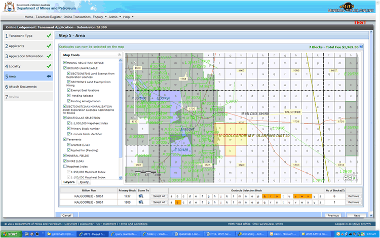
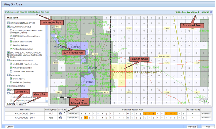
The area can be interactively selected on a block by block basis as part of the application process. The mapping view allows you to zoom, pan, query and visualise the area of interest for the selection and definition of the application area. The mapping view also shows existing live and pending tenements in conjunction with layers that show ground un-available.
Note: At this stage the block selection process provides basic functionality and does not perform any geo-processing of the selected polygon to determine if it contiguous or affected by other land use. That functionality will come in a future release. However it does streamline the Application process and reduce errors through "what you select and see is what you are applying for".
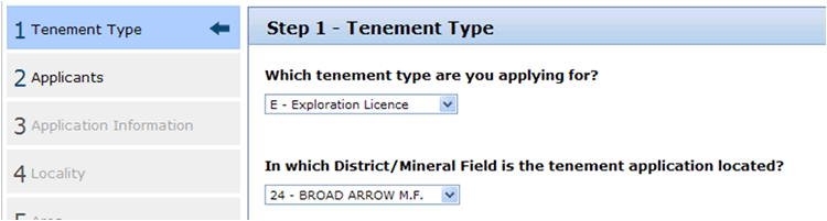
Select the Tenement Type (Exploration Licence) and the District/Mineral Field. The District/Mineral Field selected at this stage is used for the initial extent of the mapping view when first displayed (refer to the diagram in the 'Map Components' section above)
You can now zoom and pan to the geographical area of interest, and commence the block selection process which involves selecting the individual 1m x 1m blocks.
Once the selected blocks start to appear in the block selection below the map, you can also select blocks in the table view (refer to the diagram in the 'Map Components' section above). This is a quicker option when large selection areas are being applied for.
When your block selection is complete move to Stage 6 - Attach Documents. The Form21 Attachment 2 will have been automatically generated and can be views by selecting the ![]() icon at the top of the page. The generated attachment 2 will also be emailed to you if you proceed with the application.
icon at the top of the page. The generated attachment 2 will also be emailed to you if you proceed with the application.
Note:
- The layers are scale dependent and may not turn on until you are at pre-determined scales.
- If you are not zoomed in sufficiently or the graticule selection layers are not showing you will get a message "Please zoom in to select graticules:"
- Ensure all layers are selected before moving to Stage 6 - Attach Documents
- The total fee is displayed in the top corner of the map view.
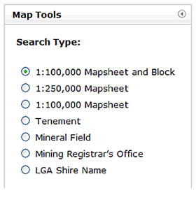
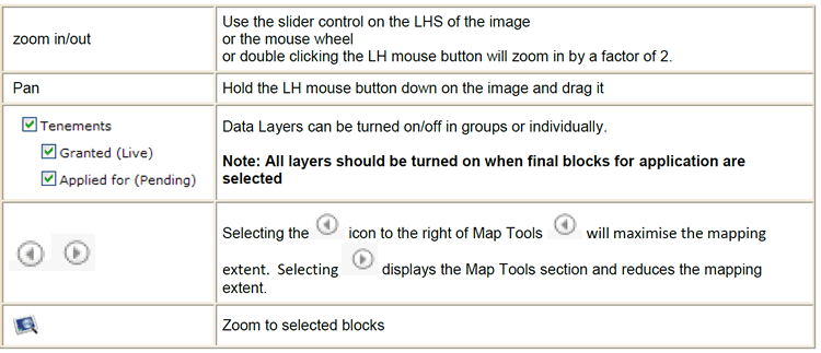
The query section in Map Tools provides basic functionality to enable a user to zoom to specific spatial locations.
The different search options can be accessed by selecting the radio button and selecting or entering the search criteria.
Note:
- The Tenement Search will search for a Tenement ID across both the live and pending layers.