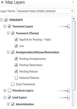
Layers Viewable
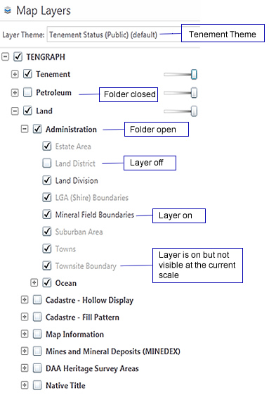
TIP - Click on the layer name to find its display properties
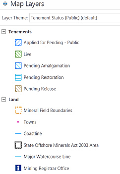
|
||||
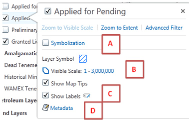
| Visible range (Shows the scale the layer is visible when turned on.) | ||||
| Label Display (Some layers permit labels to be customised or turned on or off) | ||||
| Metadata (Opens a technical data description) |
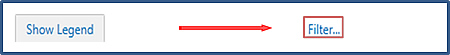
Legend filter (Use the Filter box to list only the map layers you want to see)
Tip: The Legend Filter is located near the bottom just to the right of the Show Legend / Layers button.
Tip: Click on ![]() and type in Hydrology to find the map layer affecting bores, dams, wells and tanks.
and type in Hydrology to find the map layer affecting bores, dams, wells and tanks.
![]()
Click on the X will close the Legend Filter.