Why change?
HTML5 Viewer Upgrade
- TENGRAPH Web running the HTML5 viewer does not require plugins.
- Supported across multiple browsers and devices (desktop computers, smartphones and tablets).
- Supported on windows and non-window platforms.
- Faster Searches and Map display.
Most of the Tools and Features remain unchanged in the HTML5 release of TENGRAPH Web. However, there are new enhancements and changes to the way some menus are opened.
HTML5 Operational Changes and Enhancements
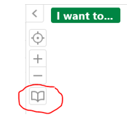
- Bookmarked Locations has a new icon.

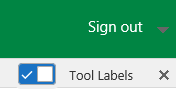
- A new Tool Labels toggle shows or hides the tool labels.
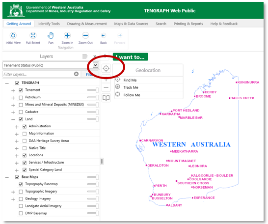
- The "I want to..."
 menu button has a new colour.
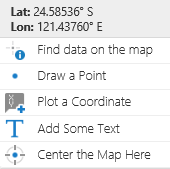
- Geolocations - "New tablet / smartphone feature".
Click on the ![]() icon for the Geolocation options to appear
icon for the Geolocation options to appear
Geolocation locates the user on the map. The HTML5 Viewer supports the following geolocation options:
- Find Me: Pans the map to the user's location and marks the location with an indicator.
- Track Me: Tracks the user's location with an indicator, without panning the map.
- Follow Me: Follows the user's location with an indicator and pans the map as the user's location changes.
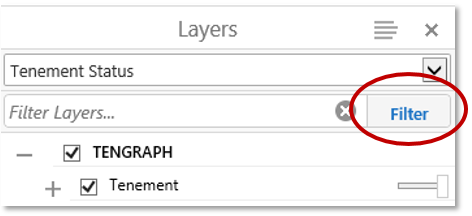
- The position of the Map Layer Filter tool is easier to access. It has moved from the bottom of the information panel to the top.
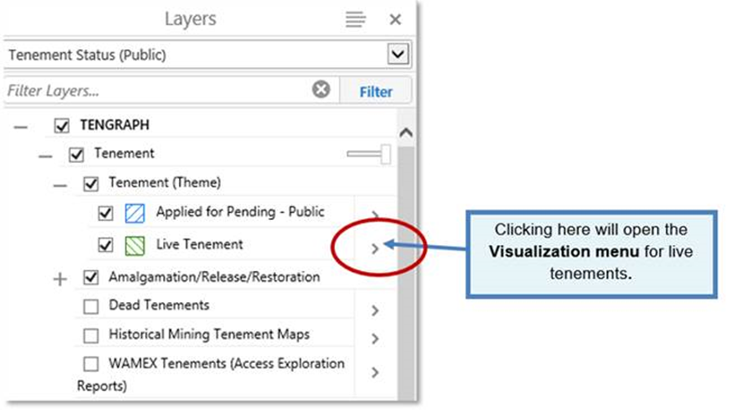
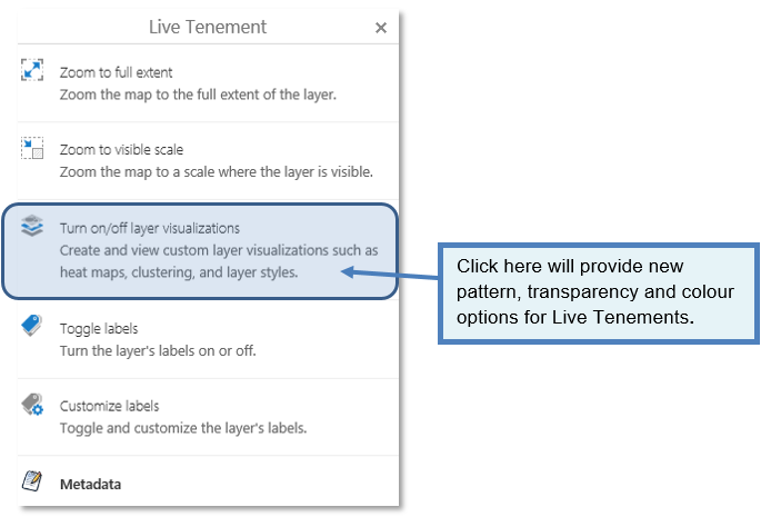
- Change Colour or Pattern of a Layer
You will need to click on the Map Layer ![]() icon to open the colour and pattern Customisation Tools as shown below.
icon to open the colour and pattern Customisation Tools as shown below.
(The right mouse click does not work in HTML5)
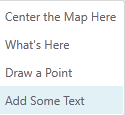
- The right mouse map display click - Context Menu change.
|
New HTML5 Menu |
Old Silverlight Version |
|
|
|
- Map layer Results are summarised in the side Information Panel.
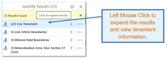
Right mouse button clicks do not work in the result and map layer panels.
New Action menus: opened/closed by a left mouse click on an icon.
|
Icon |
Menu |
Tools |

|
Opens the Results Action Menu |
|
|
|
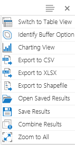
Opens the Panel Actions Menu |
|
|
|
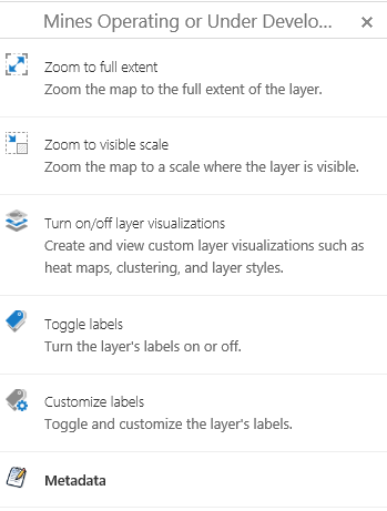
Opens the Map Layer Action Menu |
|
|
|
Click to Expand Results
|
|
|
|
Go Back to panel (Collapse Results) |
|
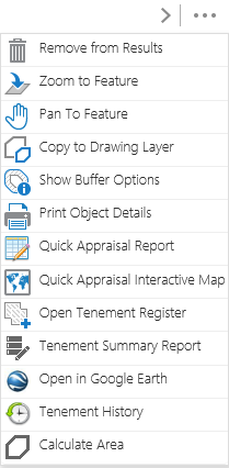


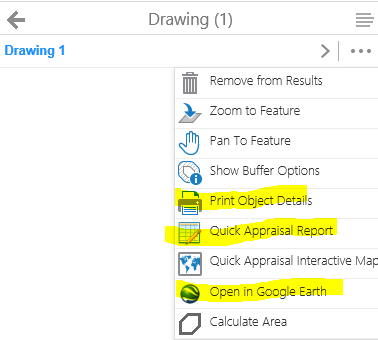
- Open Tenements/Drawings in Google Earth enhancements
HTML 5 - exports Polygons and Measurements into Google Earth.
HTML 5 - exports more than one tenement into Google Earth.
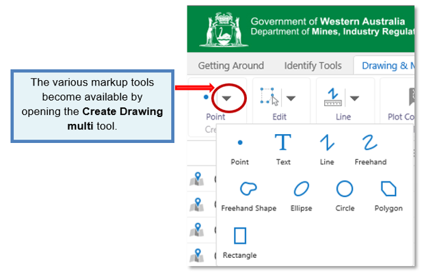
- Create drawing tools are grouped together in a new drop down menu.
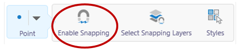
- Snapping tool has changed.
The HTML5 Snapping Tool has to be "enabled" for precisely drawing shapes adjacent to other TENGRAPH objects.
Snapping while holding the Ctrl key while creating a drawing does not work in HTML5.
This improvement allows users to select actions from the one menu.
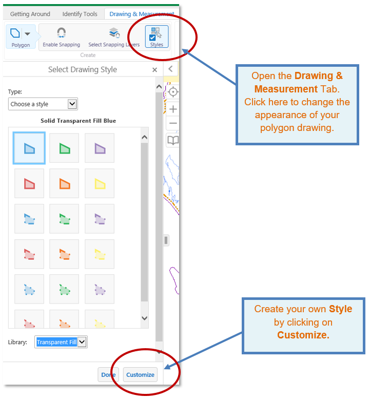
- Polygon Colour Enhancement
New pattern and colour styles provided, or create your own!
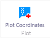
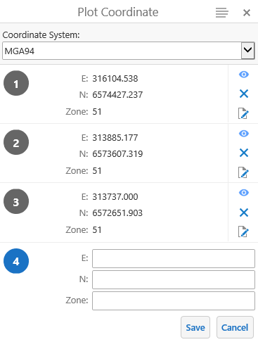
- Plot Coordinate tool enhancement.
 It also labels the created point on the map display.
- Maps & Data Sources Tab - The upload tool allows csv, xlsx (containing map coordinates) and shape files to be added from your computer onto the map as a graphics layer.
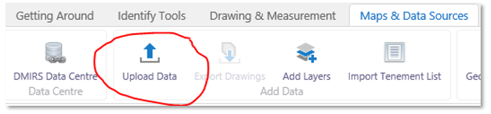
Note: The new version does not support dragging the shape file directly onto the map display. (You have to upload the file from your computer)
- The location of "Saving and opening projects" has moved from the tool bar to the "I want to... Menu."
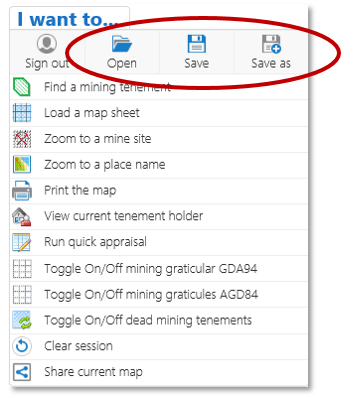
Note: Projects previously saved in the Silverlight viewer cannot be opened in the new TGW HTML5 viewer.
Click here for more tips, information and answers to FAQ questions.