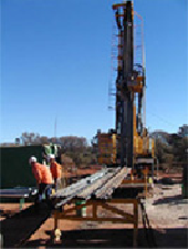
Co-funded Drilling Program Round 14
Round 14 of the Exploration Incentive Scheme (EIS) Co–funded Drilling Program will be open for applications from 5 September 2016.
![]()
 The online system for applications for co-funding of drilling projects to be undertaken in the 2017 calendar year, will open on 5 September and will close at 5 pm (WST) on
14 October 2016.
Updated information will be available on the DMP website on 5 September, or from Margaret Ellis, Coordinator EIS or by telephone on (08) 9222 3509.
![]()
Spotlight on two products — East Kimberley Reports
GSWA has recently released two Reports on the east Kimberley region. The following abstracts are provided for information on the results.
Report 157 A geophysical investigation of the east Kimberley region, northern Western Australia
byMD Lindsay1, SA Occhipinti1, JA Hollis2, AR Aitken1, V Metelka1, MC Dentith1, JM Miller1, and IM Tyler

1. Centre of Exploration Targeting, The University of Western Australia, 35 Stirling Highway, Crawley, Perth WA 6009
2. Currently Ministry of Finance and Mineral Resources, PO Box 1601, 3900 Nuuk, Greenland
The geology of the east Kimberley region was investigated through an integrated geophysical and geological approach. Emphasis was placed on identifying geological structures and features that may be important for assessing the mineral potential of the region. Subsurface architecture was constrained through combined gravity and magnetic modelling along three transects. Significant crustal-scale structures were interpreted and investigated to determine their potential influence on the development of the regional architecture, the emplacement of magma, and the circulation of hydrothermal fluids within the Halls Creek Orogen. Newly interpreted features include three orogen-normal structures, and another regional structure that runs obliquely across the Halls Creek Orogen from beneath the Speewah Dome. The geophysical interpretation delineated a zone of high-grade metamorphic rock that is bounded by two of the orogen-normal structures. A major positive gravity anomaly has been modelled as a source of excess mass in the mid-crust; this is compatible with a large mafic–ultramafic intrusion, or a crustal fragment. We propose a model involving the accretion of this crustal fragment to the Kimberley Craton prior to the 1865–1850 Ma Hooper Orogeny. Accretion of the crustal fragment led to the propagation and creation of the orogen-normal and oblique structures. The structures represent weak zones in the crust, which may have led to differential exhumation of crust during the 1835–1810 Ma Halls Creek Orogeny, and formed fluid conduits in a mineral system.
Download a PDF version of the Report.
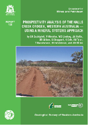
Report 159 Prospectivity analysis of the Halls Creek Orogen, northern Western Australia — using a Mineral Systems Approach
bySA Occhipinti1, V Metelka1, MD Lindsay1, JA Hollis2, AR Aitken1, S Sheppard3, K Orth4, IM Tyler, T Beardsmore, M Hutchinson and JM Miller1
 1. Centre of Exploration Targeting, The University of Western Australia, 35 Stirling Highway, Crawley, Perth WA 6009
2. Ministry of Finance and Mineral Resources, PO Box 1601, 3900 Nuuk, Greenland
3. Western Australian School of Mines, Curtin University, Bentley WA 6102
4. CODES, ARC centre of excellence in ore deposits, University of Tasmania, Private Bag 50, Hobart TAS 7001
Opening up greenfields regions of Western Australia for mineral exploration programs is best facilitated through the understanding of regional mineral prospectivity. A multi-commodity mineral systems analysis has been carried out as the basis for prospectivity analyses and mapping in the greenfields Halls Creek Orogen in northern Western Australia. Known mineral occurrences or deposits in the region formed from c. 1860 to 350 Ma, largely influenced by periods of supercontinent assembly and breakup, manifested in the region through the contractional 1865–1850 Ma Hooper and 1835–1805 Ma Halls Creek Orogenies and the 1000–800 Ma Yampi, c. 560 Ma King Leopold, and 450–295 Ma Alice Springs Orogenies interspersed with periods of relaxation accompanied by extension and basin formation.
Prospectivity models were generated for seven commodity groups of various ages and ore genesis mechanisms within the region that include combinations of Ni, Cu, PGE, V, Ti, Au, Pb, Zn, and diamonds. A link was found between key mineral systems and prospectivity model components and the distribution of disparate styles of mineral deposits in the region. Crustal-scale tectonic architecture was analysed by combining a 2D map view geological–geophysical interpretation with 2.5D magnetic and gravity joint inversions of selected profiles, a 3D Moho gravity inversion (MoGGIE), and inferences derived from a 2D magnetotellurics experiment conducted in the northern part of the region. Different ‘zones’ (tectonic terranes) of the Halls Creek Orogen are prospective for diverse commodity groups due to the tectonic environment in which they developed through time, their potential to be preserved at the present day surface or subsurface, and favourable depositional sites that may be present in these zones (structural or lithological). Major crustal-scale faults or shear zones that intrinsically control the location of known ore deposits in the area are implied to be sites of fluid migration and proximal to sites of ore deposition. Of these, orogen-perpendicular (northwesterly trending) and orogen-oblique (northerly trending) faults seem to be the most influential structures with respect to ore deposition in the Halls Creek Orogen, especially in regions where they intersect each other or orogen-parallel (northeasterly trending) major crustal-scale structures.
Download a PDF version of the Report.
Accompanying data in a zip file can be found here.
GSWA FREE database training — 2016
The Geological Survey of Western Australia (GSWA) offers FREE training in its databases and online systems. The training is in the form of a presentation, with hands-on interaction in most systems.
Topics include:
- navigating the department’s website
- searching for geoscience publications
- finding digital datasets using the Data and Software Centre
- searching for open-file mineral exploration reports using WAMEX
- searching the mineral drillholes and geochemistry databases
- bringing it all together with the interactive map viewer, GeoVIEW.WA, and GeoMap.WA, a standalone GIS viewer for Windows.
A desktop computer will be available for each participant.
Perth session — 2016
The Perth training has been divided into separate sessions: one for prospectors, and one for mining companies/geologists.
Venue: No. 1 Adelaide Terrace, East Perth
Thursday 27 October
Prospectors — morning
9.30–9.45 Welcome and web systems
9.45–10.45 GeoVIEW.WA
10.45–11.00 Tea break
11.00–12.00 GeoMap.WA
12.00–12.30 Questions and activities
Mining companies/geologists — afternoon
1.30–1.45 Welcome and web systems
1.45–2.45 GeoVIEW.WA
2.45–3.00 Tea break
3.00–3.45 WAMEX/drillholes/geochemistry
3.45–4.30 Questions and activities
Please confirm attendance and advise which sessions you wish to attend. If you find that you cannot attend for any reason, please let us know with some notice so we can let someone on the waiting list fill your place.
Kalgoorlie session — 2016
The Kalgoorlie training is open to all. This session will be part of ‘GSWA in the Goldfields’ activities.
Venue: 34 Cheetham Street, Kalgoorlie, central campus for the Goldfields Institute of Technology, Kalgoorlie
Thursday 10 November
Morning
9.30–10.00 Welcome and web systems
10.00–11.00 GeoVIEW.WA
11.00–11.15 Tea break
11.15–11.45 WAMEX (minerals exploration report database)
11.45–12.15 Mineral drillholes and geochemistry databases
12.15–1.00 Lunch break
Afternoon
1.00–1.45 GeoMap.WA
1.45–3.00 Individual sessions — specific examples, queries and issues relating to GSWA Web Systems and applications covered in the training session.
Company-specific training on site
GSWA also provides tailored database training at company premises. The sessions can cover all the topics covered in the sessions mentioned above. Please contact Cindi Dunjey on 9222 3168 or cindi.dunjey@dmp.wa.gov.au for more information.
Sign up now for FREE training!
See our website for more details. To register, send an email to publications@dmp.wa.gov.au including your details (name, company name and telephone), with the location and date of the training you wish to attend.
GSWA in the Goldfields — activities on Thursday 10 November
GSWA is opening its doors with ‘GSWA in the Goldfields’ on Thursday 10 November with a number of discrete events at different venues during the day, culminating at Hannans Club with three talks as part of the Raglan Series (aka KEG) starting at 5pm.
More information will be available soon. For enquiries and to register your interest, please email cindi.dunjey@dmp.wa.gov.au.
Latest releases
REPORTS
Report 127 Deposition, provenance, inversion history and mineralization of the Proterozoic Edmund and Collier Basins, Capricorn Orogen
by Cutten, HN, Johnson, SP, Thorne, AM, Wingate, MTD, Kirkland, CL , Blay, OA, Belousova, EA and Zwingmann, H
Report 157 A geophysical investigation of the east Kimberley region, northern Western Australia
by Lindsay, MD, Occhipinti, SA, Hollis, JA, Aitken, ARA, Metelka, V, Dentith, MC, Miller, J and Tyler, IM
Report 159 Prospectivity analysis of the Halls Creek Orogen, Western Australia — using a mineral systems approach
by Occhipinti, SA, Metelka, V, Lindsay, MD, Hollis, JA, Aitken, AR, Sheppard, S, Orth, K, Tyler, IM, Beardsmore, T, Hutchinson, M and Miller, JM
Accompanying data in a zip file can be found here.
Report 160 Archean geology of the northwest Pilbara Craton, Western Australia
by Hickman, AH
RECORDS
Record 2016/8 The evolution of mafic and ultramafic rocks of the Mesoproterozoic Fraser Zone, Albany–Fraser Orogen, and implications for Ni–Cu sulfide potential of the region
by Maier, WD, Smithies, RH, Spaggiari, CV, Barnes, SJ, Kirkland, CL, Kiddie, O and Roberts, MP
Record 2016/10 Evolution and deformation of the onshore Eucla Basin during the Cenozoic
by Mounsher, LC
Record 2016/12 Komatiites and associated rocks of the Kalgoorlie–Leonora region
by Barnes, SJ, Mole, DR and Wyche, S
Record 2016/13 13th International Ni-Cu-PGE Symposium, Fremantle, Australia: Abstracts
by Godel, B, Barnes, SJ, Gonzalez-Alvarez, I, Fiorentini, ML and Le Vaillant, M
1:100 000 GEOLOGICAL SERIES MAPS
BADJA, WA Sheet 2240
By Zibra, I, Ivanic, TJ, Chen, SF, Clos, F, Li, J, Gu, P, Meng, Y, Yu, J and Wang, C
BUNGAR, WA Sheet 2539
by Ivanic, TJ
1:250 000 GEOLOGICAL SERIES MAPS
DRYSDALE – LONDONDERRY, WA Sheet SD 52-9 and part of Sheet SD 52-5
by Phillips, C and de Souza Kovacs, N
WEBB, WA Sheet SF 52-10
by Spaggiari, CV, Haines, PW, Tyler, IM, Allen, HJ, de Souza Kovacs, N and Maidment, D
NON-SERIES MAPS
Manganese deposits of the Pilbara Craton and Capricorn regions — 2016
by Strong, CA
DATA PACKAGES
Compilation of geochronology information, 2016
East Albany–Fraser Orogen Geological Exploration Package 2016
East Yilgarn, 2016
Kimberley, 2016
Murchison, 2016
South Yilgarn, 2016
Tanami–Arunta, 2016
West Musgrave, 2016
Pricing and availability
Maps, USB data packages, and selected premium publications are available to purchase as hard copies via the online cart on the eBookshop. Alternatively, these products can be purchased from the Information Centre, First Floor, Mineral House, 100 Plain Street, East Perth WA 6004, Australia, Phone: +61 8 9222 3459; Fax: +61 8 9222 3444.
Records, Reports, Bulletins and non-series books cannot be purchased in hard copy but are all available as PDFs to view, and as a free download.
If products do not have a URL link, they have just been released and will be available online soon.
DISCLAIMER
Products were produced using information from various sources. The Department of Mines and Petroleum (DMP) and the State cannot guarantee the accuracy, currency or completeness of the information. DMP and the State accept no responsibility and disclaim all liability for any loss, damage or costs incurred as a result of any use of or reliance whether wholly or in part upon the information provided in this publication or incorporated into it by reference.
Subscribe to Fieldnotes
 Fieldnotes is a quarterly publication released by GSWA to provide the State's exploration industry and other geoscientists with an update on our latest work and ongoing programs. The publication provides updates on other GSWA products and services and is available free from the Information Centre located on the first floor of Mineral House, 100 Plain Street, East Perth 6004. Find past issues of Fieldnotes here or subscribe to receive a hard copy by emailing publications@dmp.wa.gov.au.
Access GSWA products
You can view and download maps, reports, and digital information free of charge from our website.
Click on these links to take you to the download or launch page for that product:
- Geoscience information, maps and reports
- GIS versions of maps and links to web services
- Interactive geological map (GeoVIEW.WA)
- Explanatory Notes System (ENS)
- Promotional flyers and posters
- GeoMap.WA GIS software
- Mineral deposits and mine information (MINEDEX)
- Mineral exploration reports (WAMEX)
- Petroleum and geothermal information (WAPIMS)
- TENGRAPH online
- Airborne geophysics index (MAGIX)
- Geochronology
- Geochemistry (GeoChem Extract)
- Petroleum and Geothermal Register (PGR)
Hard copies
Maps, USB data packages, and nine premium publications are available to purchase as hard copies from the eBookshop or the First Floor counter at Mineral House, 100 Plain Street, East Perth WA 6004. A new online cart and payment system is in place. Records, Reports, Bulletins and other non-series books cannot be purchased in hard copy but are all available as PDFs to view and download free of charge.
Contact us
For information on publications, email publications@dmp.wa.gov.au
or telephone +61 8 9222 3459/ fax +61 8 9222 3444.
For information on digital data, email the Digital Data Administrator on gsd.dda@dmp.wa.gov.au or telephone +61 8 9222 3816.
Physical address
Mineral House
100 Plain Street
East Perth WA 6004
www.dmp.wa.gov.au/gswa
For more information about GSWA and its products, go to our website.