1. Open the Drawing & Measurement Tab.
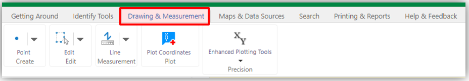
2. Select the Create Graticule Polygon and Description tool from the Enhanced Plotting Tools menu.
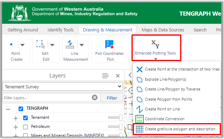
3. On the Map click on one of the blocks displayed. The Million Plan Name, primary number and graticule details are updated in the panel.
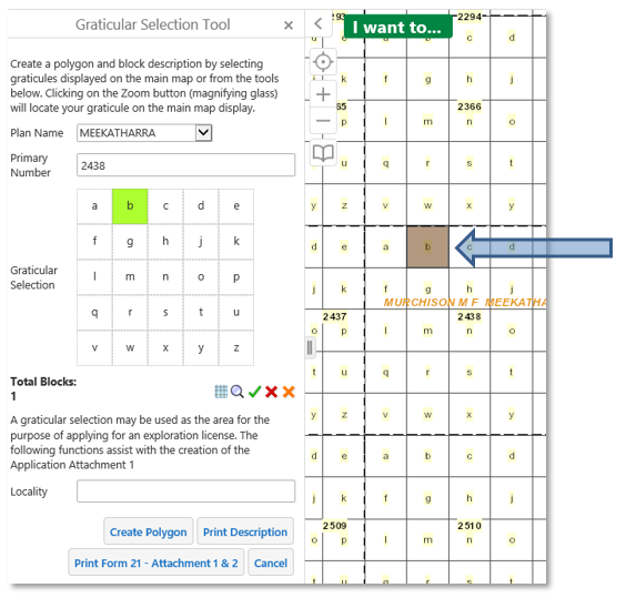
4. Continue to select blocks.
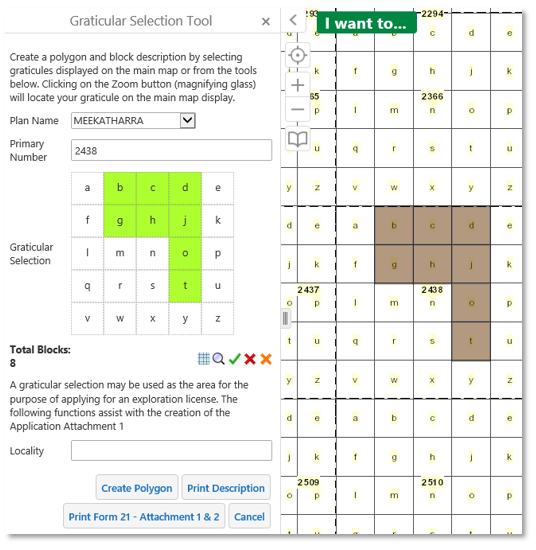
5. A total of 8 blocks have been selected. Re-click on a block to delete it. The total number of blocks selected has been reduced to 7.
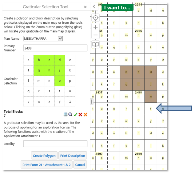
6. Once you have completed selecting your blocks you have the option of creating a polygon, printing a Form21 - Attachment 1 and 2 or block description.
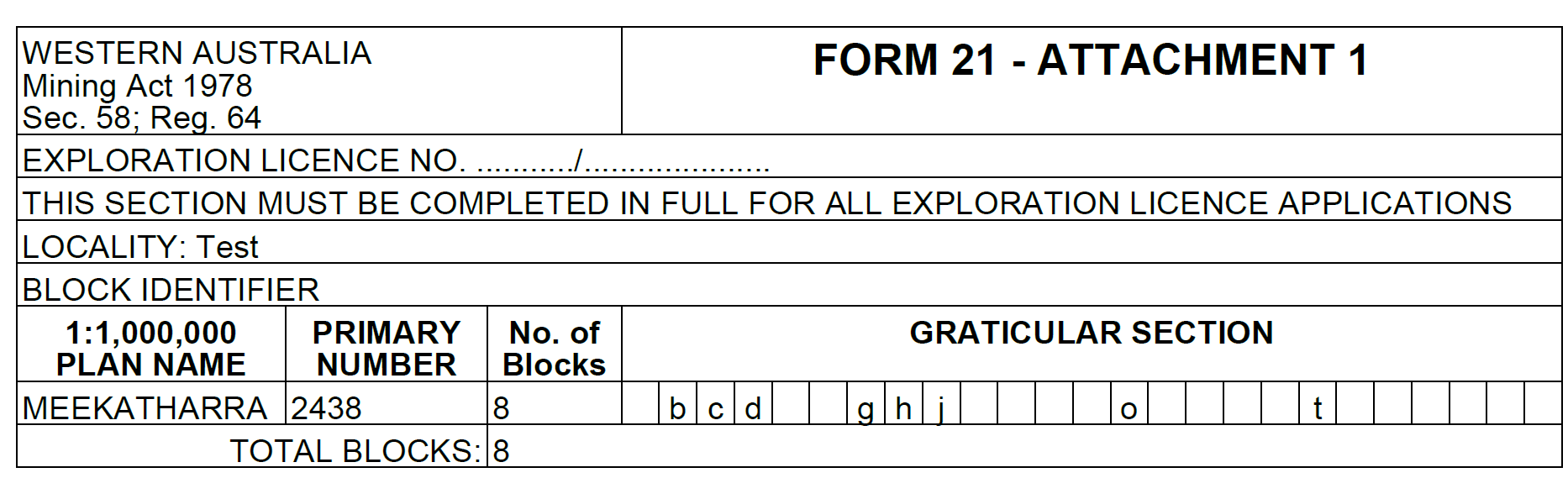
7. You will need to type in a Locality before the Form 21- Attachment 1 will print.
8. Click on the Download link to open the report.
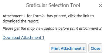
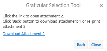
9. The Print preview tool is not available for Form 21 Attachment 2 prints. Ensure the graticule blocks display is in the centre of the map at an appropriate scale before printing the Attachment 2.
10.Consider uncluttering the map display by turning off layers.
![]()
11. Download Attachment 2 when it has completed processing.
Graticule Selection Tools
1. ![]()
![]() Toggle ON/OFF mining graticules.
Toggle ON/OFF mining graticules.
![]() Zoom to a primary number.
Zoom to a primary number.
![]() Select all 25 the graticules within a primary number.
Select all 25 the graticules within a primary number.
![]() Clear all graticules from the current primary number view.
Clear all graticules from the current primary number view.
![]() Clear all graticules
Clear all graticules
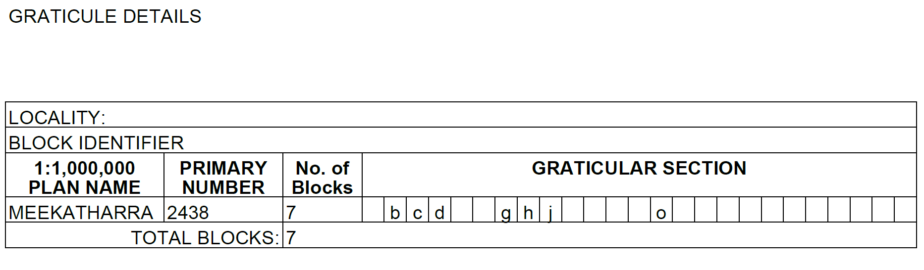
Example of downloaded graticule description.
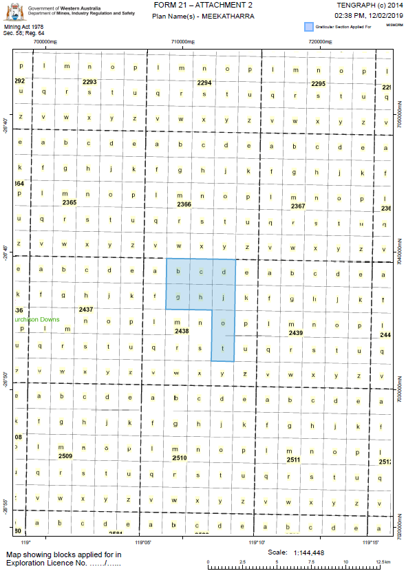
Example of a TENGRAPH Web Form21-Attachment 2