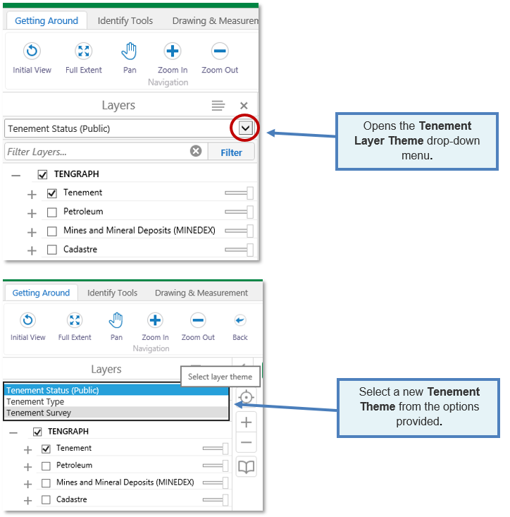
TENGRAPH Web has three preset tenement theme displays, which can be chosen from the Layer Theme drop-down menu.
- Tenement Status Public (default display)
- Tenement Type
- Tenement Survey
You can switch between these display options as required.
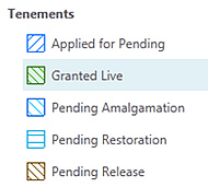
This is the default theme that portrays live tenements with a green pattern and a blue pattern for pending tenement applications.
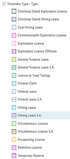
This theme colours current tenements by their type.
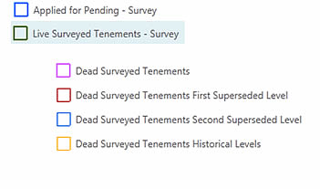
In this theme Unsurveyed tenement boundaries are portrayed with a broken border.
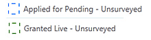
Tenements surveyed by a licenced surveyor are portrayed with a solid line.
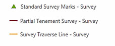
Survey Traverse Lines
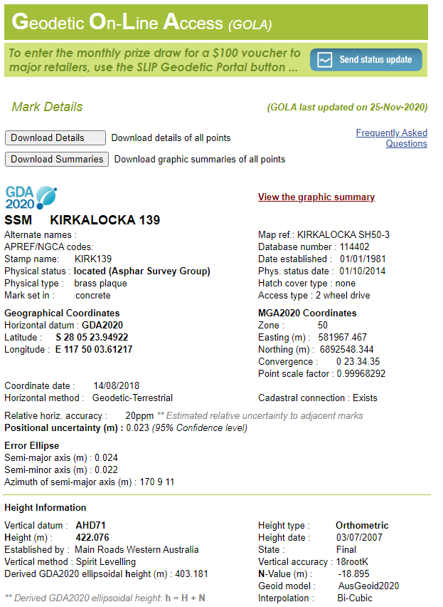
Standard Survey Mark - Attributes
- From within the Tenement Survey Layer Theme, identify a survey mark from the map display.
- Expand the results.
- Click on the Standard Survey Marks Name.
- The Information window opens with its attributes displayed.
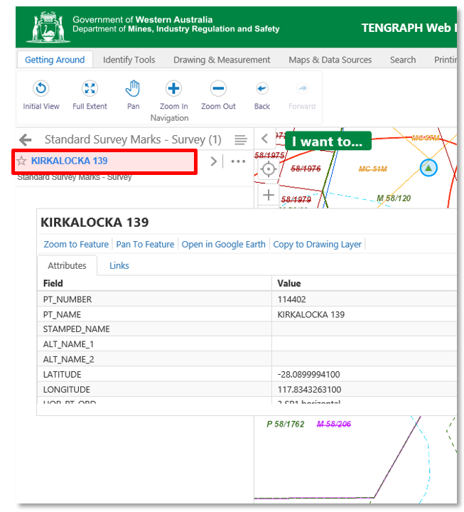
- Further information is available by clicking on the Landgate's Geodetic Online System (GOLA) link.
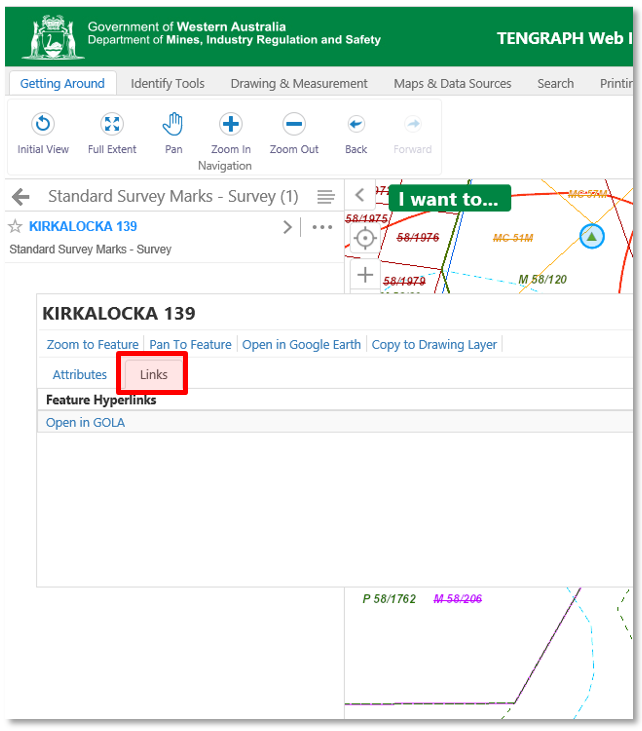
This link provides access to geodetic information for Standard Survey Marks (SSMs) and Benchmarks (BMs) within Western Australia, Cocos-Keeling Islands and Christmas Island.
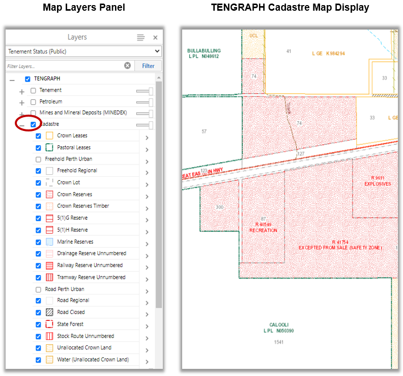
Clicking on the Cadastre Folder will make these layers visible at predetermined map scales. This means you will have to zoom in for freehold regional land to become visible on the map display.
Perth Urban freehold land and road isolations will need to be manually ticked on before they become visible.
Please Note:
1. The TENGRAPH Cadastre display is updated from Landgate approximately every three months.
2. It is provided for information purposes only and is not guaranteed. For the latest Cadastre please refer to Landgate.
3. Where the information is being used for legal purposes then the original documents must be searched from Landgate.
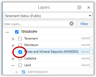
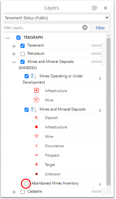
Click on the Mines and Mineral Deposits (MINEDEX) folder to display all known mining related sites in WA.
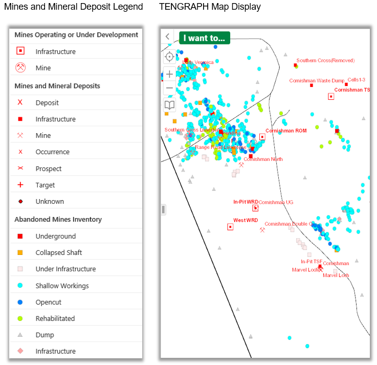
The abandoned mine sites shown in TENGRAPH have been surveyed by the Department. Abandoned mine sites may be dangerous and the Department does not encourage or recommend you venture on or near them. The abandoned mine site inventory does not cover the whole of Western Australia.
The information is intended to increase your awareness of the location of those surveyed sites and their potential dangers.
For information about the Abandoned Mines Program click here.
If this information is not required you can turn the display off by unticking the Abandoned Mines Inventory Map Layer located in the Mines and Mineral Deposits (MINEDEX) Folder as shown below.
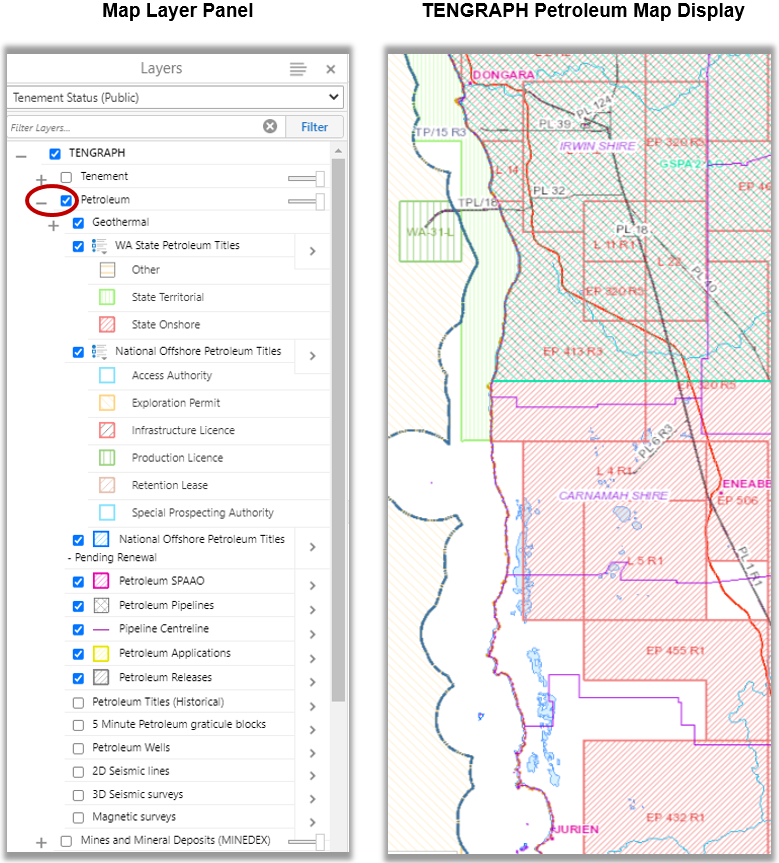
Selecting Petroleum from the Layers panel will display petroleum and geothermal related information.
Search By Petroleum Title
Open the Search tab and click on the Petroleum icon.
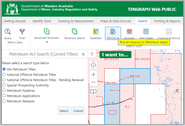
Select the Petroleum type.
Enter the Petroleum Title ID; and press the Search button.
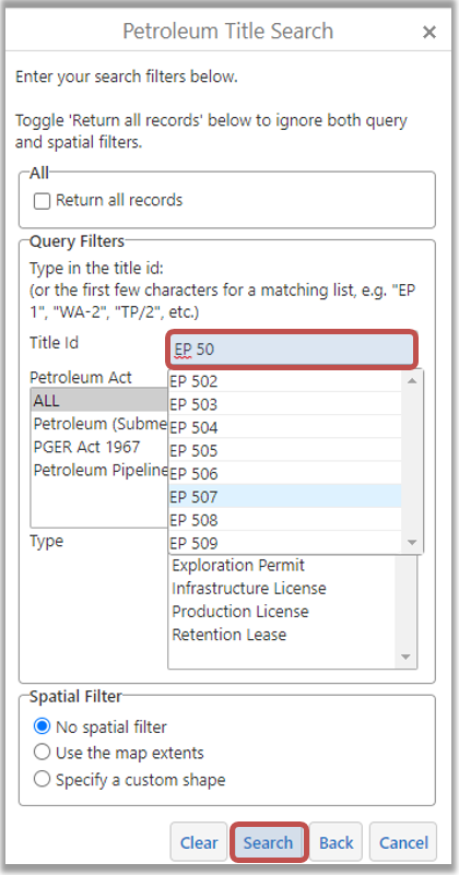
If you are unsure of the title ID select the Return all records check box and then Search.
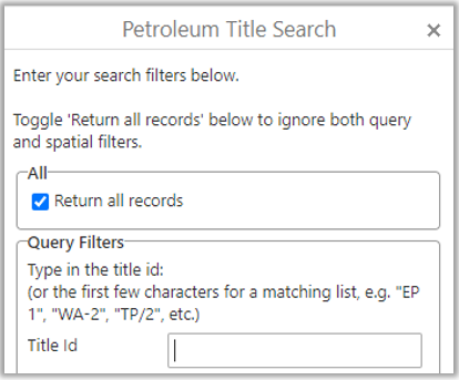
The Results panel will list the affected Petroleum Titles.
Click below to learn about petroleum and geothermal titles:
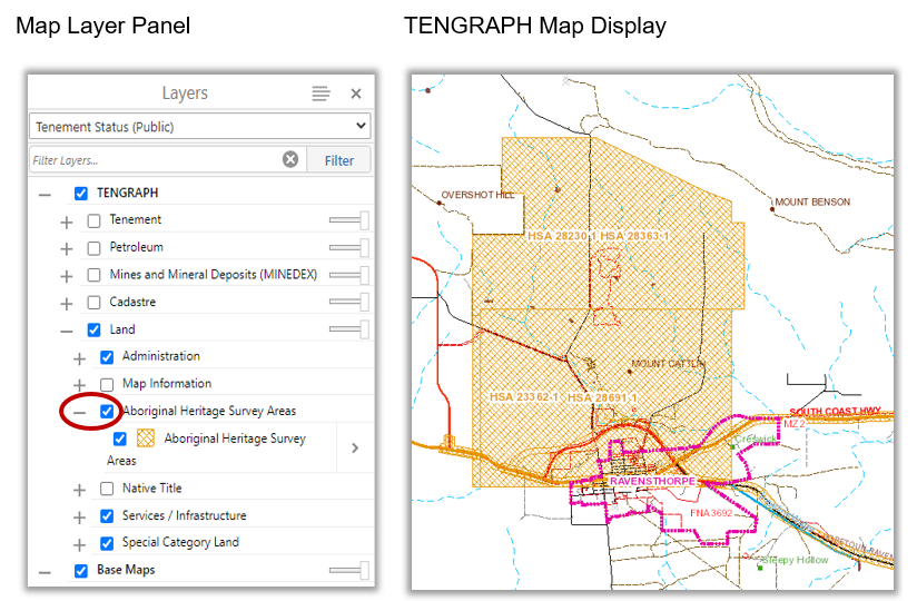
Click on the Aboriginal Heritage Survey Areas layer check box for them to display on the map between scales 1:35 and 1:2,311,162.
To view any of the Heritage Survey Reports, please contact the Department of Planning, Lands and Heritage.
Selecting the Native Title folder from the Layers panel will display Native Title related information on the map.
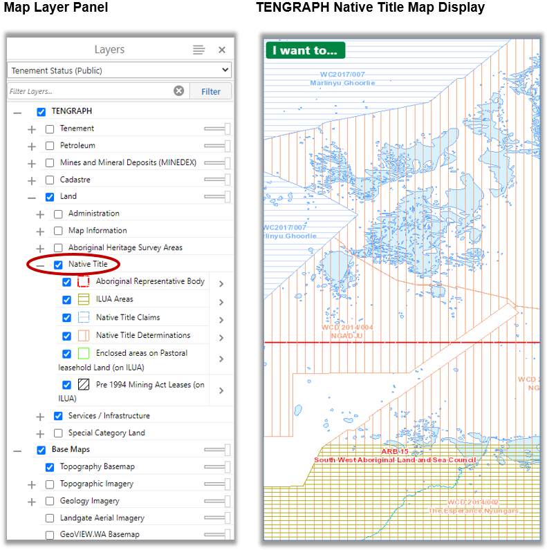
Native Title data shown in TENGRAPH is managed by Landgate and the National Native Title Tribunal.
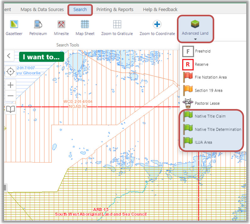
Search by Native Title
Open the Search tab and click on Advanced Land.
You can choose to search by Native Title Claim, Determination or ILUA name or number.
To access tenement exploration reports expand the Tenement Layers Folder and turn on the WAMEX layer as shown below:
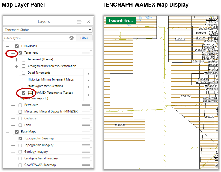
Tenement boundaries included within mineral exploration reports are displayed with a horizontal pattern between map scales 1:35 and 1:577,790.
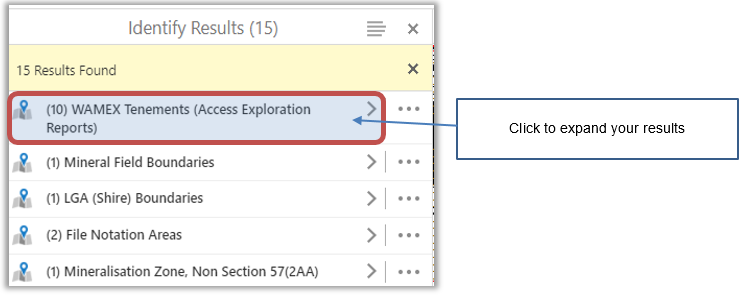
Use of the map identify tools to list WAMEX tenements in the Results panel.
Click on the WAMEX Tenement (Access Exploration Reports) from the Results panel.
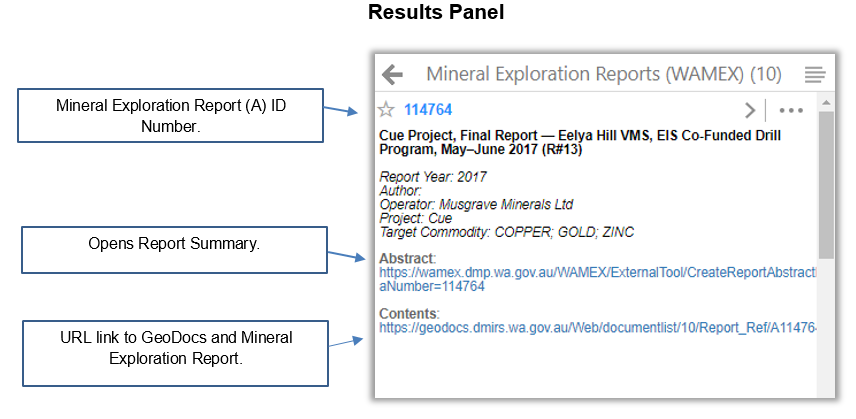
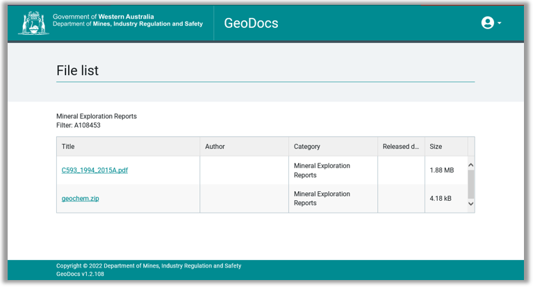
Clicking on the Contents: URL opens a new GeoDocs tab where you can download the report to your device.
Click here for information about annual mineral exploration reports lodged and stored in the Western Australian Mineral Database (WAMEX).