This tool shows coordinates for specific locations on the map. Coordinates are created precisely or by selecting a location on the map with a mouse.
- Within the Drawing & Measurement toolbar select Plot Coordinates.
- Alternately, right-click on the map and select the Plot a Coordinate tool from the Context menu.

- When activated the coordinate display options become available in the left panel.
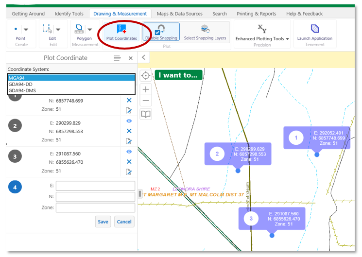
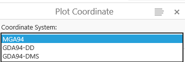
- Choose a Coordinate system from one of the 3 the options.
- Click or tap a location on the map will plot a coordinate.
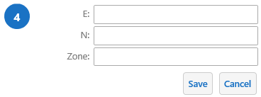
- The Plot coordinate tool allows users to enter their own coordinates.
- The Plot Coordinate side bar menus contain the pan, hide, delete and modify tools.

Plotted coordinates or other constructed drawings exist only for the duration of the session.
Save your drawings for another session by creating a project or exporting them as a shape file.