This section of the manual describes how to access the drop down menus containing the most commonly used TENGRAPH tools.
I want to... menu
The ![]() is a drop down menu containing frequently used TENGRAPH searches and tools.
is a drop down menu containing frequently used TENGRAPH searches and tools.
This menu tries to anticipate what you will want to do most often.
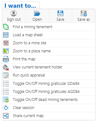
Most of I want to... tools are also available in the Toolbar Tabs.
Context Menu
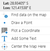
The context menu provides latitude and longitude coordinates and frequently used navigation, identify and drawing tools.
Open the Context menu with a right mouse click anywhere on the map.
Press and hold your finger on the map to open the context menu using a handheld device.
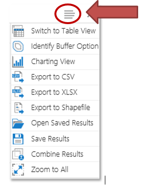
Click on the Results Layer Action menu icon when the Results is the active panel.
- Only results from DMIRS map layers are available for export as a shapefile.
- To obtain data layers sourced from other agencies download the Acknowledgment page for contact details.
- Visit our Data and Software Centre for DMIRS state-wide spatial datasets.
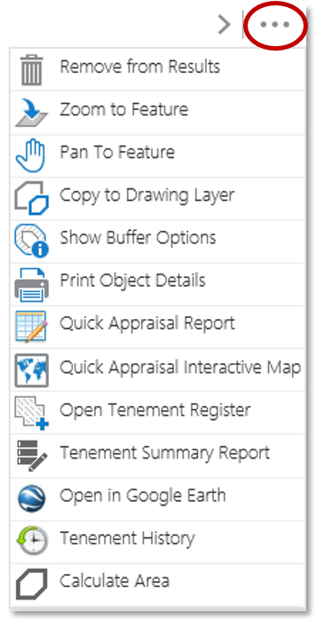
Results List Menu (Feature Action Menu)
Click on the Feature Actions menu icon ![]() on individual features in a Results List or Results Table.
on individual features in a Results List or Results Table.
Note: The summarised Layer results will need to be expanded for the Feature Actions menu ![]() to appear.
to appear.
Click here for information about these tools.