Below is a description of the TENGRAPH tools available from the Feature Action Menu.
Use one of the identify tools or the Find data on the map tool to generate some results.
Expand the layer Results and open the Feature Actions menu ![]() on individual features in a Results List or Results Table as shown below.
on individual features in a Results List or Results Table as shown below.
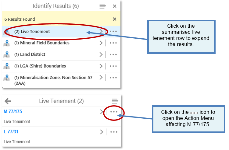
Mining Tenement Action Menu Tools:
|
Use this tool... |
To... |
Example... |
|
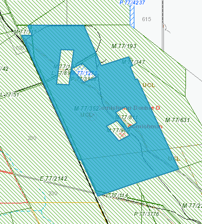
Copy to Drawing Layer
|
Copy a TENGRAPH feature or object to the drawing or mark-up layer. Useful for identifying the feature/object in a different colour from surrounding features. TIP - Use the "Copy to drawing" tool to portray a mining tenement boundary in a different colour for your printed map. |
|
|
Print Object Details
|
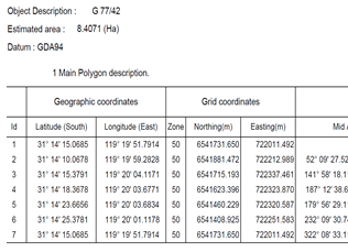
Print the spatial coordinates of a TENGRAPH object identified in the Results.
Surveyed tenement boundaries are printed with a solid line; unsurveyed boundaries are printed with a broken line. Unsurveyed boundaries abutting surveyed boundaries are printed with broken lines.
|
|
|
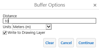
Show Buffer Options
|
Add a buffer around a TENGRAPH feature/object.
An option is provided to show the buffer as a drawing on the map.
|
|
|
Quick Appraisal Report
|
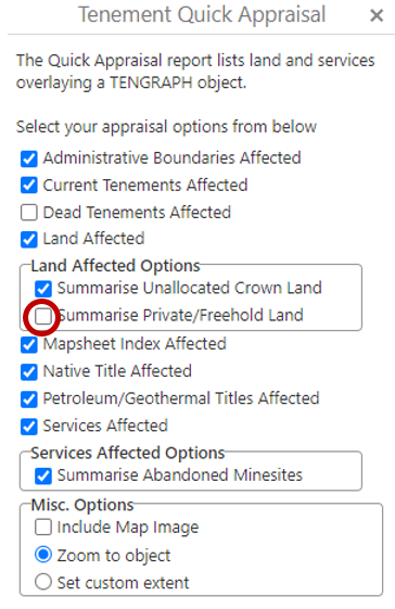
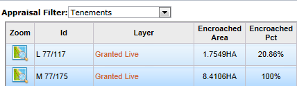
The Quick Appraisal Report lists land and services overlaying a TENGRAPH feature or object.
The quick appraisal will finish sooner if fewer options are selected.
To see all the private/freehold land affected untick the Summarise check box. |
|
|
Quick Appraisal Interactive Map
|
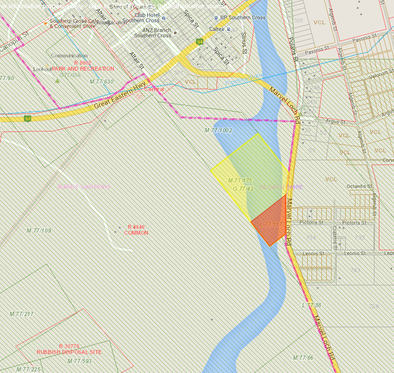
View the land affecting a TENGRAPH feature or object in Google Maps.
Land intersections are highlighted on the interactive map.
|
|
|
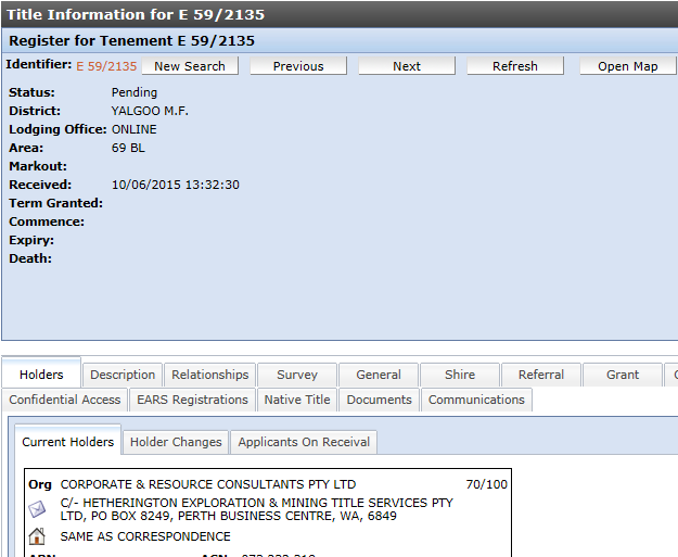
Open Tenement Register
|
Open Mineral Titles Online providing additional mining tenement textual information, dealings and conditions. |
|
|
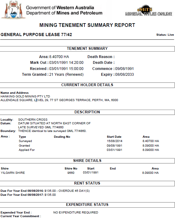
Summary Report
|
The Mining Tenement Summary PDF report provides basic tenement information such as the status and current holder contact details.
|
|
|
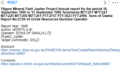
Mineral Exploration Report
|
Open Links to related Mineral Exploration open-file (public) reports stored in the WAMEX database.
The downloaded report contains records on exploration progress and results. |
 |
|
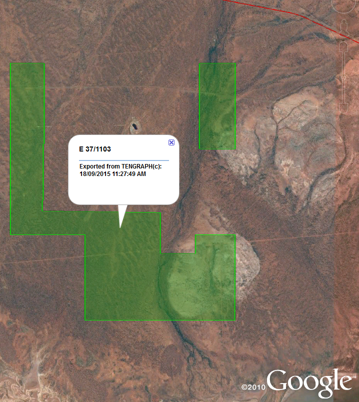
Open Google Earth
|
Display DMIRS spatial boundaries in Google Earth.
For this feature to work, your device will need Google Earth installed. |
|
|
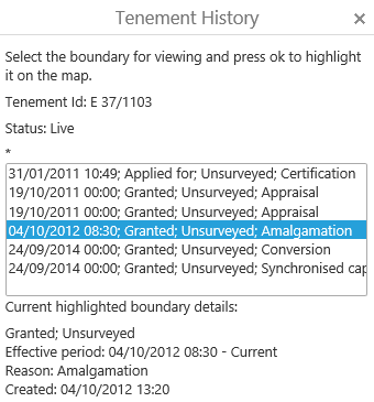
Tenement History
|
View previous tenement boundaries, why they were altered and when they were effective.
|
|
|
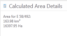
Calculate Area
|
Calculate the spatial area in square kilometres and hectares of a feature or object listed in the results panel.
|
|


Related: The ![]() menu.
menu.