Geological Survey Western Australia (GSWA) designs new electronic book for geological data.
| Date: | Friday, 10 November 2017 |
|---|
An innovative tool that will modernise the way geologists use and store large datasets has been designed by a team from the Department of Mines, Industry Regulation and Safety.
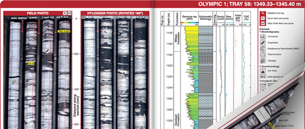
The Digital Core Atlas is an interactive electronic book containing large volumes of analytical data linked to detailed core photographs from Olympic 1, a petroleum well located in the north of Western Australia.
The department’s Geological Survey Division, or GSWA, designed the atlas during the Canning Basin Drilling Project, a collaboration between GSWA, Geoscience Australia and two exploration companies, Buru Energy and Finder Exploration.
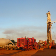
The project began in 2015 when continuous sections of core totalling 1383.18 metres were recovered from three wells, Olympic 1, Theia 1 and Senagi 1. Thousands of samples were analysed for petroleum systems and CO2 sequestration studies.
Olympic 1, drilled on the Broome Platform, cored a continuous section from the base of the Willara Formation through nearly all of the Nambeet Formation. Before this, only a limited amount of core existed from this Lower to Middle Ordovician section of the stratigraphy.
GSWA Senior Geologist Leon Normore said the drilling project greatly increased the existing available core from the Nambeet Formation, making the data highly valuable for stratigraphic and petroleum systems analysis.
“The rocks in this region don’t outcrop, so the core is extremely interesting - particularly with 320m of core of the Nambeet Formation from Olympic 1 available to analyse,” Mr Normore said.
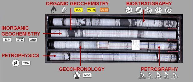
“We were able to do multiple-analysis on whole sections of rock and with so many different datatypes, it was proving hard to keep up with where the results came from within the core, hence the development of this product.”
Mr Normore said GSWA wanted to create an interactive, user-friendly tool to display every detailed photograph of the cored section and allow users to click through to the related data.
“Using Flipbuilder software, the main pages of the atlas display core images on the left and a well log and legend for the dataset on the right. The images include field photos of core taken immediately after retrieval from core barrels and a Hylogger photo taken at the department’s Core Library in Perth.
“Icons are placed on the field photos corresponding to the position of samples taken and analysis type. Each icon is linked to the data recovered from that individual sample and the results are accessed with a simple mouse click.
“The location of the individual core tray is also marked on the adjacent well log to provide the user with a clear understanding of which part of the stratigraphy they are viewing.”
Mr Normore said GSWA would produce a similar atlas for Finder Exploration’s well, Theia 1, which would contain analytical datasets for more than 700 metres of core, double the data for Olympic 1.
“Feedback from anyone who has seen the product has been extremely positive and industry is impressed by the possibilities,” Mr Normore.
The Digital Core Atlas for Olympic 1 is available on a USB, which can be ordered on the department’s website for $55 or can be downloaded free of charge from GSWA’s petroleum exploration database – the Western Australian Petroleum and Geothermal Information Management System.