Worldwide, carbon capture and geological storage (CCS) is the technology considered to have the greatest potential to mitigate greenhouse gas emissions from large-scale fossil fuel usage.
What is geosequestration?
The trapping of carbon dioxide (CO2) in deep underground formations is known as geosequestration. CO2 gas can be converted into a supercritical fluid in the presence of heat and compression. Conditions exist below about 800 metres underground which ensure injected CO2 remains as a supercritical fluid.
In converting CO2 from a gas into a supercritical fluid, its volume is reduced by about 400 times. CO2 in this liquefied state exhibits the properties of both a liquid and a gas, and can be permanently stored in sedimentary formations of porous rock, such as sandstone, lying deep beneath the Earth's surface.
Underground formations of sandstone, which are saline aquifers are recognised as suitable reservoirs for the permanent storage of CO2 Ideally storage reservoirs will be covered by a layer of impermeable caprock to ensure that the CO2 remains permanently trapped deep within the earth.
The CO2 remains trapped in a similar way to a naturally occurring gas deposit which has existed deep in the substrata of the earth for millions of years.
Read more about geosequestration.
Projects
The Geological Survey of Western Australia (GSWA) is involved in specific projects both in collaboration and on its own. Key projects are outlined below.
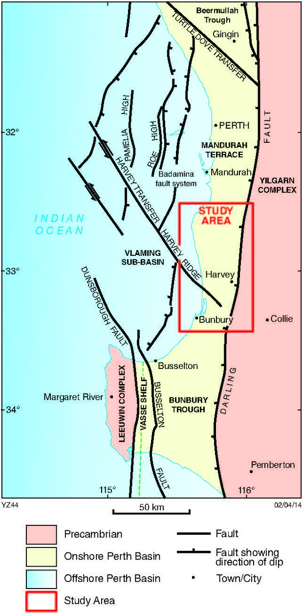
South West Hub project
GSWA has been directly involved in management of the geoscientific data collection program for the initial 2D Lower Lesueur seismic survey and GSWA Harvey 1 stratigraphic well. Both are part of the South West Hub CCS project South West Hub project. This project was jointly funded by the State and Commonwealth Governments, and industry. State funding was from the Royalties for Regions Exploration Incentive Scheme (EIS).
The Lower Lesueur 2D seismic survey was a collaborative program with Geoscience Australia (GA), which collected approximately 106 kilometres of 2D seismic data along roads in the Harvey and Waroona shires. The interpreted data was used in the planning of GSWA Harvey 1 and is reported as Record 2014/7 2D seismic interpretation of the Harvey area, southern Perth Basin, Western Australia.
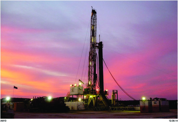
GSWA Harvey 1 stratigraphic well was completed in early 2012 and was successfully drilled to a depth of 2945 metres, GSWA’s deepest drillhole. This was performed to obtain data to help assess the potential of the Triassic Lesueur Sandstone as a reservoir for the geosequestration of CO2. The well is located on a structural feature known as the Harvey Ridge, a poorly defined northwesterly–southeasterly trending basement high observed in seismic data and associated with a high gravity anomaly. The well was drilled using a conventional petroleum rig and included four core intervals along with a full mud logging and wireline logging suite. A total of 217 metres of 100 millimetre diameter core was recovered from the well.
Detailed research using the downhole log data and samples from the well is by being carried out by scientists from CSIRO, The University of Western Australia, Curtin University and GSWA. Completed reports covering this research are available from the Western Australian Petroleum Information Management System (WAPIMS). The GSWA Harvey 1 well completion and preliminary interpretation report has been released as Record 2014/12 GSWA Harvey 1 well completion and preliminary interpretation report, southern Perth Basin.
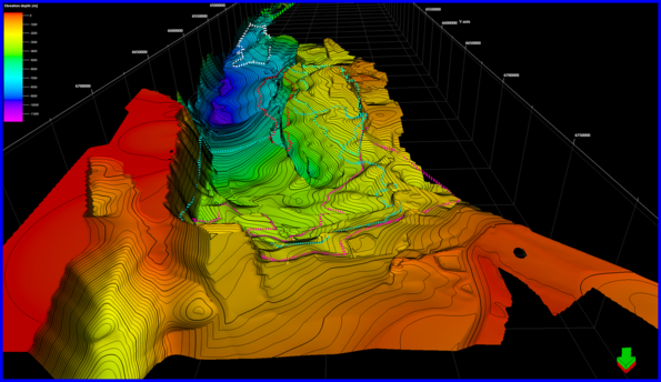
From February to April 2014, as follow up to the completion of Harvey 1, a three dimensional (3D) seismic survey was undertaken over about 115 square kilometres of the area surrounding Harvey 1. The survey was undertaken to help better understand the subsurface geology and to assist in selecting locations for up to four additional wells. GSWA has provided geological advice and assistance for the seismic interpretation and this drilling program, which is underway.
The 3D dataset was officially released by the Minister for Mines and Petroleum at the GSWA Open Day in February 2015 and is available from WAPIMS. Find additional information on the survey, including images from the interpretation 3D Seismic Survey.
Western Australia Carbon Dioxide Geological Storage Atlas
In early 2011, GSWA appointed 3D GEO Pty Ltd to prepare a CO2 storage atlas covering the main onshore basins of Western Australia. The primary focus of the Atlas was on the geological and geophysical interpretation of the main storage target intervals in the onshore Canning, Carnarvon and Perth Basins.
The study was funded by the Exploration Incentive Scheme (EIS), part of Royalties for Regions, and undertaken using the department’s significant and highly valued open-file well and seismic data collected by Petroleum Division and in some cases mineral companies (WAPIMS).
The atlas is available as Report data package 126 Western Australia carbon dioxide geological storage atlas with an accompanying GIS dataset. The atlas comprises four separate chapters. An introduction outlines the purpose of the atlas, how the technical evaluation has been structured, and a summary of the prospectivity. The three main onshore basins – Perth, Carnarvon and Canning – are discussed in separate chapters.
__rdax_620x352.png)
CO2 storage assessment of the onshore Western Eucla Basin
GSWA contracted FROGTECH Pty Ltd to undertake a first-pass assessment of the potential for carbon geosequestration of the onshore western Eucla Basin. Initial assessment involved determining the size and depth of potential sub-basins, and the thickness and lithology of the Eucla Basin stratigraphy.
The full report on the study, funded by the Royalty for Regions EIS is published as Report 138 CO2 storage assessment of the on-shore western Eucla Basin. This Report discusses the methodology and results of the assessment and the accompanying ArcGIS project (with all information on USB) contains a compilation of the datasets and images used.
Collaborative research project with The University of Western Australia and CSIRO Petroleum
The tectonic evolution and geosequestration potential of the Canning Basin were evaluated by two recent studies funded by GSWA under the EIS. The work was carried out by the Centre for Petroleum and CO2 Sequestration at The University of Western Australia, and CSIRO Petroleum.
Report 140 Regional structural and stratigraphic study of the Canning Basin, Western Australia assesses the style and timing of tectonic events across the Canning Basin, and reviews the geological history and stratigraphic framework of the basin, with detailed interpretation of the Fitzroy Trough. The Report presents a digital geological model integrating seismic reflection and potential field data with geological data from wells and other geophysics. Digital data related to this Report, including 2D seismic and well data (Kingdom Suite Project) and a digital model of the Fitzroy Trough (GoCAD), are available.
Report 139 Geosequestration potential of the Carboniferous–Permian Grant Group and Permian Poole Sandstone, northwest Canning Basin, Western Australia. It assesses the CO2 storage potential of Carboniferous–Permian reservoirs within 200 kilometres of James Price Point. Three potential fault-block geosequestration sites are identified.
Contact
For further information contact:
Carbon.Strategy@dmirs.wa.gov.au