Step 3.3 contains Guidance text which is to be read by the User.
The Sites Plan must clearly and accurately reflect the information in the text and data included in the tables.
The minimum requirements for the Site Plan are:-
- All operations and areas disturbed should be drawn on the plan with the scale clearly shown
- All tenements and their boundaries indicated
- Include topographical, mine-site infrastructure details and cadastral information
- Include areas rehabilitated to date with year completed.
- Show areas disturbed during the reporting period
- Show areas proposed for disturbance during the following reporting period
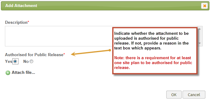
At least one site plan must be authorised for public release.
.png)
To attach a site plan, complete a description of the document, indicate whether the site plan is authorised for public release and click on [Attach file] to select the file for uploading.
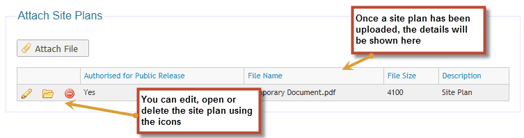
Once the Site Plan has been uploaded, you can edit, open or delete it by selecting the appropriate icon.
 Previous Page