Exploration
Exploration is the basis for a successful petroleum industry. Before any exploration work can start, the petroleum company must consult with landholders about the possible impacts of exploration. Both the landholder and the company can then negotiate a ‘land access agreement’. The main steps in exploration and possible impacts on the land include the following:
Studies and data processing
Activity: Data from the Department of Mines, Industry Regulation and Safety (DMIRS) Geological Survey WA will help to identify areas with the best potential for exploration work.
Existing seismic data is processed by computers to gain extra knowledge about the rocks underground.
Impacts: No impact on the community or the environment.
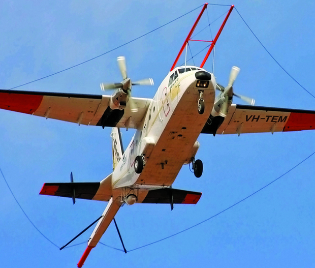
Airborne surveys
Activity: Airborne surveys are carried out by fixed wing aircraft or helicopters flying approximately 300 metres above the ground. In the aircraft there are computers that take readings of the earth’s magnetic and gravity signals. This gives the petroleum companies information about the potential for further studies.
Impacts: Short term noise but no significant impacts.
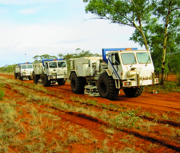
On-ground surveys
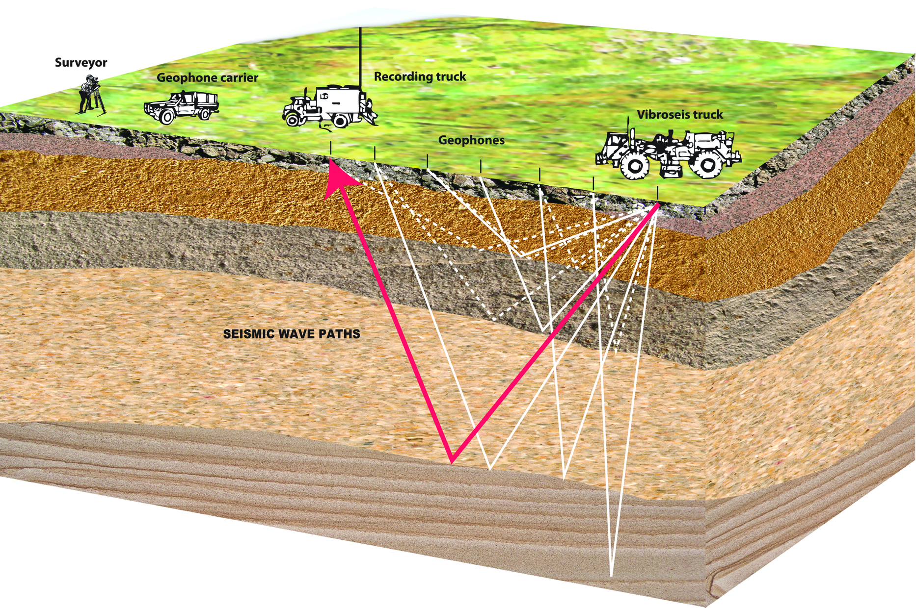
Activity: There are several different types of on-ground surveys. Some use handheld instruments to take readings or small samples. The most common on-ground survey is a seismic survey. This type of survey uses trucks with vibrator pads to send small sound waves deep below the ground. These waves bounce back from the rock to be picked up by sensitive microphones placed on the ground. The recordings create two-dimensional or three-dimensional pictures of the underground geology.
Impacts: The surveys using hand held instruments have no significant impact on the land.
Seismic surveys can be conducted from existing roads and tracks, but often require clearing of vegetation needed for equipment and vehicles. The path of any proposed seismic lines can be changed to protect heritage sites. These surveys can require teams of up to 50 workers, housed in temporary accommodation. Seismic survey areas are rehabilitated once the survey work is finished.
Drilling a petroleum exploration well
Activity: Exploration drilling for oil and gas can be approximately four kilometres deep, into layers of rock. If the exploration program finds a petroleum resource, testing is needed to determine the quality and amount of oil and/or gas in the well. Test results will help the company decide whether the discovery has any commercial potential.
Impacts: A drilling site covers an area about the size of a football oval and can take several months to drill. Petroleum wells are designed and constructed according to strict safety, engineering and environmental standards, which are checked by the department. When drilling is finished, the well is made safe and the area rehabilitated. If the well is to be used later a two metre high well-head structure known as a ‘Christmas tree’ will be erected to allow for controlled production.
Discovery of petroleum
When a discovery is made, the petroleum company needs to establish how best to develop the resource. The company is required to make a ‘declaration of location’ to the department before applying for a production license. Further exploration is permitted in the permit area. The production licence application requires comprehensive assessment before commercial operations can be approved.
Rehabilitation
Most land disturbed by petroleum operations is rehabilitated once exploration work is finished. The structures are removed and the land is replanted with native vegetation. The only exceptions are drill sites which might be used in future production. These are kept and maintained until production starts.
Key facts
- A land access agreement must be in place before exploration can start.
- Some types of exploration work have little impact on the land.
- Petroleum companies can plan where activities take place to make sure heritage sites are protected.
- For every petroleum activity an environment plan and a safety plan must be submitted to the department for assessment and approval.
For more information check out other information sheets in this series by visiting Native Title and Land Access (NTALA) or Telephone (08) 9222 3333