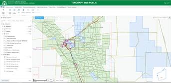
TENGRAPH Web is a spatial enquiry and mapping system displaying the position of Western Australian mining tenements and petroleum titles in relation to other land information. It provides a current and accurate picture of land under mining activity and is used to determine ground that is available for mineral exploration.
TENGRAPH Web
- Support for desktops, tablets and handhelds
- Operates on Windows, Android and IOS
- Supports multiple internet browsers (HTML5 compliant)
- No plugins required
- Integrated Geolocation support
- Improved performance
- Familiar interface with functional changes to support multiple devices
Visit About TENGRAPH Web for troubleshooting, help videos and supporting documents
Contact
For general help in using the TENGRAPH systems and interpreting mining tenement information contact the Mining Information Centre or your regional mining registrar’s office.
Mining Information Centre
Phone: +61 (08) 9222 3626
Email: mineraltitles.enquiries@demirs.wa.gov.au
For TENGRAPH access and technical issues please contact the Department’s IT Service Desk
IT Service Desk
Phone: +61 8 9222 0777
Email: IT.SERVICEDESK@demirs.wa.gov.au